Select or drop a image or 3D model here to search.
We support JPG, JPEG, PNG, GIF, WEBP, GLB, OBJ, STL, FBX. More formats will be added in the future.
Asset Overview
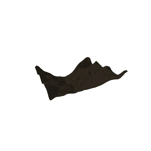
Ollantaytambo is a village in the Sacred Valley of Urubamba, Peru, set on the Urubamba River amid snow-capped mountains. It's known for the archaelogical ruins, a massive Inca fortress with large stone terraces on a hillside. Major sites within the complex include the Sun Temple and the Princess Bath's fountain. (Source: Google)
* Generator: [DEM Net Elevation API](https://elevationapi.com)
* Digital Elevation Model: [AW3D30 OpenTopography](https://opentopography.org/)
* Imagery: [MapBox Satellite](https://www.mapbox.com)
References:
J. Takaku, T. Tadono, K. Tsutsui : Generation of High Resolution Global DSM from ALOS PRISM, The International Archives of the Photogrammetry, Remote Sensing and Spatial Information Sciences, pp.243-248, Vol. XL-4, ISPRS TC IV Symposium, Suzhou, China, 2014.
T.Tadono, H.Ishida, F.Oda, S.Naito, K.Minakawa, H.Iwamoto : Precise Global DEM Generation By ALOS PRISM, ISPRS Annals of the Photogrammetry, Remote Sensing and Spatial Information Sciences, pp.71 - 76, Vol.II - 4, 2014.