Select or drop a image or 3D model here to search.
We support JPG, JPEG, PNG, GIF, WEBP, GLB, OBJ, STL, FBX. More formats will be added in the future.
Asset Overview
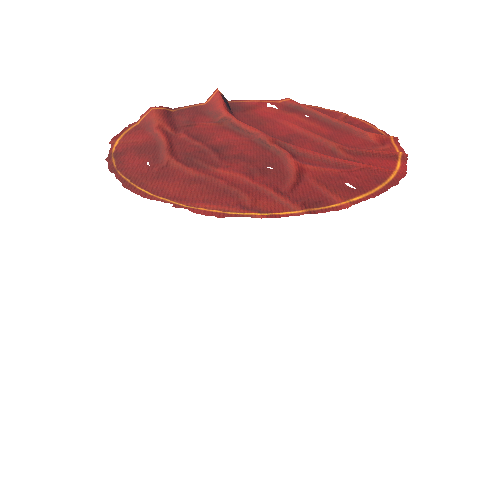
Mound B is located north and west of the six concentric ridges and 2050 ft (625 m) north of Mound A. The mound is roughly conical in form and is approximately 21 ft (6.5 m) in height with a 180 ft (55 m) basal diameter. Dating to sometime after 1700 BC, Mound B was the first earthwork built at Poverty Point. Built in several stages, charcoal, fire pits, and possible postmolds were found at various levels within the mound. The impressions of woven baskets were preserved in the fill of an upper level of the mound construction. The final stage of the mound construction was a conical silt loam lens that covered the entire mound surface. [WIKI](https://en.wikipedia.org/wiki/Poverty_Point


/Screenshots/uploads_files_2091084_plate_MESH (1)_110.webp)

/Screenshots/SM_doily (1)_110.webp)