Select or drop a image or 3D model here to search.
We support JPG, JPEG, PNG, GIF, WEBP, GLB, OBJ, STL, FBX. More formats will be added in the future.
Asset Overview
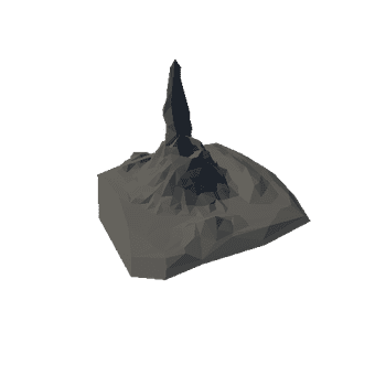
THis has been scanned with a 2020 ipad pro using Lidar.
The monument (Southrepps, Norfolk) includes the remains of a standing stone cross located at the south east corner of a crossroads, on the route to Bromholm Priory, and known as `Stump Cross'. The cross, which is Listed Grade II, dates from the medieval period and includes the socket stone and the lower part of the shaft.
The socket stone, which is set into the ground diagonally to the crossroads, measures 0.54m square at the base by 0.28m high, rising through chamfered corners to an octagonal section on the surface. The shaft, which is bonded onto the socket stone with concrete, measures 0.28m square in plan and 0.96m high. A mortise hole in the top of the shaft has a diameter of 40mm and a depth of 70mm. The full height of the cross in its present form is approximately 1.24m.