Select or drop a image or 3D model here to search.
We support JPG, JPEG, PNG, GIF, WEBP, GLB, OBJ, STL, FBX. More formats will be added in the future.
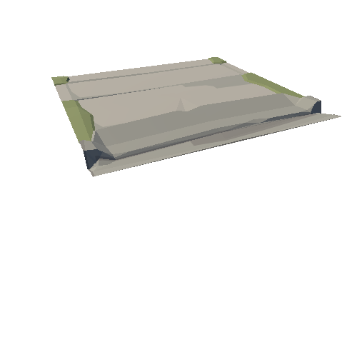
Asset Overview
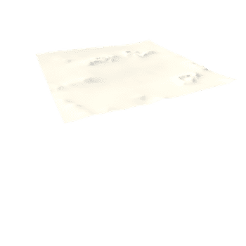
This is a LiDAR model using low relief visualisation techniques to highlight the detail in low earthworks. Bremenivm Roman fort lies near the village of Rochester, Northumberland and was in use between the 1st - 3rd centuries AD. The recorded garrisons in the 2nd century included the First Cohort of Lingones (part-mounted and 500 strong) then the First Cohort of Dalmatians (infantry). In the 3rd century the garrison was the First Cohort of Vardulians (part-mounted and one thousand strong).
To the north and west of the fort there are at least 6 Roman camps of differing dates. These relate to units either moving north to the Antonine Wall frontier, or returning south to Hadrians Wall and bases further to the south, along the Dere Street Roman road.
The fort has two clear areas of vicus settlement to the west and south east of the fort.
1 metre LiDAR from Environment Agency Geomatics http://environment.data.gov.uk/ds/survey/#/survey
LiDAR processed and model created with Planlauf Terrain software