Select or drop a image or 3D model here to search.
We support JPG, JPEG, PNG, GIF, WEBP, GLB, OBJ, STL, FBX. More formats will be added in the future.
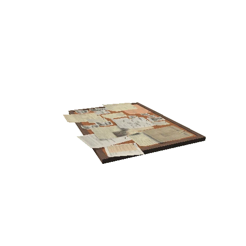
Asset Overview
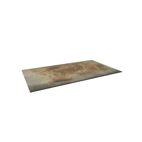
Rock art, Derreennaclogh Townland, north of Ballydehob, Co. Cork, Ireland. SMR Ref: CO131-069. Location 51.605867, -9.438929. This model is scaled and arrow points to magentic north. A second panel (Derreennaclogh-02) is located approx. 10m ENE. Both panels currently share one SMR Ref, but updates are scheulded for NMS records in near future. There is reference in correspondence from 1939 to a cairn, a stone pair, and a stone row from this townland. If indeed this was the case, these monuments are no longer extant and their original location is unknown. The Bronze Age copper mining complex at Derrycarhoon is located some 1.3km WNW.
Try the different rendering modes in 'Settings' (keyboard shortcuts: 1,2,3), manpiulate the viewing angle, or even flip the panel and view from underneath to help enhance the low-relief motifs. Generated from a photo series and processed in Agisoft Photoscan.
Please note that this site is located on private land.