Select or drop a image or 3D model here to search.
We support JPG, JPEG, PNG, GIF, WEBP, GLB, OBJ, STL, FBX. More formats will be added in the future.
Asset Overview
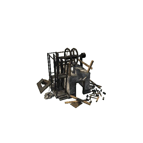
Stereokartoituskojetta käytetään korkeuskäyrien piirtämiseen kartalle. Koje toimii heijastamalla hieman eri suunnista otetut ilmakuvat, toinen sinisellä ja toinen punaisella valolla karttapöydälle, jolloin syntyy 3D-kuva alueesta. Kartta piirretään käyttäen optista mittaa, joka heijastaa 3D-kuvaan valopisteen, joka joko leijuu tai näyttää uppoavan kuvaan. Kun piste kalibroidaan maan tasoon, nähdään mittarista samalla pisteen korkeus verrattuna muihin kartan osiin.
Stereoplotter is used to draw elevations on map. Two aerial photos taken from slightly different angles are reflected on the drawingboard, the other with cyan and the other with red light, to create a 3D image of the area. The map is drawn by using an optic meter that creates a lightspot that either hovers or sinks into the image. When calibrated to the surface, the meter tells the elevation in comparison to other points on the map.
The object and 3D model: Mobilia, Finland (member of Traffic Museums Association).