Select or drop a image or 3D model here to search.
We support JPG, JPEG, PNG, GIF, WEBP, GLB, OBJ, STL, FBX. More formats will be added in the future.
Asset Overview
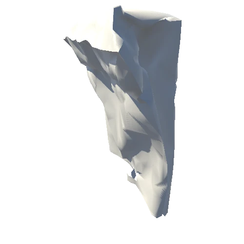
ここは関東山地から九州まで、約840kmにわたって続く三波川帯の東の端にあたります。岩畳は、結晶片岩の板のように剥がれやすい特徴である「片理(へんり)」(水平方向)と、地下深くから隆起した際にできた割れ目「節理(せつり)」(垂直方向)、そして荒川の侵食がつくった地形です。
It is located at the eastern end of the Sambagawa Belt, which stretches approximately 840 km from the Kanto Mountains to Kyushu. The rock pavement is the result of the horizontal "Henri," a feature of crystalline schist that tends to peel off like a slab, the vertical "Setsuri," fractures created by uplift from deep underground, and the erosion of the Arakawa River.
📍 [秩父郡長瀞町, 埼玉県](https://scaniver.se/L36.09505,139.11574)