Select or drop a image or 3D model here to search.
We support JPG, JPEG, PNG, GIF, WEBP, GLB, OBJ, STL, FBX. More formats will be added in the future.
Asset Overview
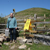
Nesscliffe Hillfort includes an enclosed area of approx. 2.8 ha on Nesscliffe Hill consisting of an inner western enclosure for the main settlement area and an eastern, possibly earlier, "annexe". The defences include 8 metre wide ditches and bivallate ramparts to the south with univallate defences on the north east side. To the west is a sheer sandstone cliff acting as a natural defence.
A small excavation inside the inner rampart of the western enclosure revealed a stone faced rampart and Roman pottery & coins dating to the 2nd - 4th c. AD. In 1956 a section through the southern inturned rampart of the NE gate produced no dating.
Much of the hillfort is still covered in woodland, but a large part of the western enclosure has recently been cleared by Shropshire County Council working with staff of the Nesscliffe Hills and Cliffe Countryside Heritage Site and the opportunity was taken to survey the site with drone photogrammetry to provide a visual and 3D condition survey during early surface regeneration