Select or drop a image or 3D model here to search.
We support JPG, JPEG, PNG, GIF, WEBP, GLB, OBJ, STL, FBX. More formats will be added in the future.
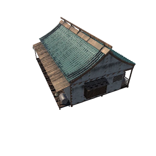
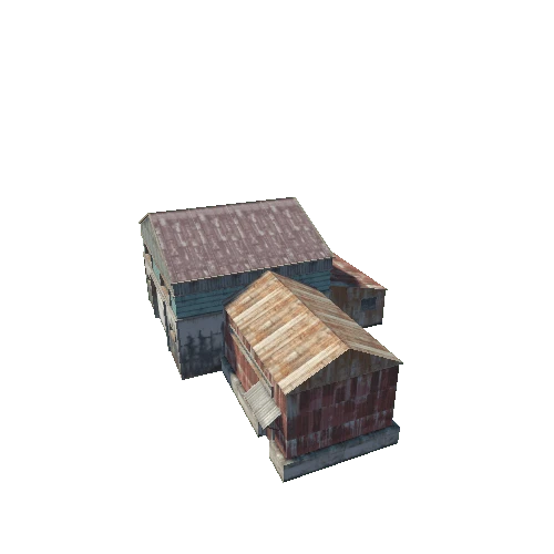
Asset Overview
This barn was scanned using a similar DIY direct georeferencing 3D-scanner as shown in this youtube-video: https://www.youtube.com/watch?v=WE_fD6qsLKQ. If you are interested in this tech, please take a look at the video and it’s description. Model shown in the video here: https://skfb.ly/6XUtD. In this scan also raster camera tracking was used, giving initial estimates for camera locations/orientations when taking pictures to be used as textures.
Faking:
* Roof was generated in point cloud-level because I couldn't reach up enough with the hand held scanner.
* Few outliers/errors were removed from the mesh and point clouds.
* Minor editing of the rasters.
Data used to generate this model (relevant GNSS and lidar-data, point clouds, rasters and MeshLab project): https://github.com/GNSS-Stylist/3D_Scan_Barn (about 3.6 GB).
When the location of the RTK-base used when scanning is known, this (including points in the scan) could be placed to it's original location/orientation with estimated accuracy of few cm.