Select or drop a image or 3D model here to search.
We support JPG, JPEG, PNG, GIF, WEBP, GLB, OBJ, STL, FBX. More formats will be added in the future.
Asset Overview
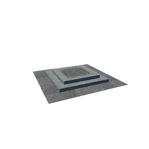
Late 12th/early 13th century Russagh (An Rosach/wood of the horses) motte-castle in County Westmeath also known locally as the 'Moat of Russagh' stands on low-lying poorly drained pasture-land with Russagh church site (WM006-062----) and graveyard (WM006-062001-) 70m to the south-east. Impressive motte consisting of a steep sided flat topped mound (top diam. 22m N-S; base diam. 35m N-S), the base of which is enclosed by a shallow fosse which is waterlogged on the northern side. The townland and parish of Russagh stands in the barony of Moygoish (Uí Mhac gCuais). In the late 12th/early 13th century during the Anglo-Norman or English conquest of this region a flat-topped mound was constructed on top of which was erected a timber-castle known as a Bretesche (Brittas). These earth and timber castles were replaced by stone castles in the 13th century. For more information on this monument, visit: https://maps.archaeology.ie/HistoricEnvironment/?SMRS=WM006-015----