Select or drop a image or 3D model here to search.
We support JPG, JPEG, PNG, GIF, WEBP, GLB, OBJ, STL, FBX. More formats will be added in the future.
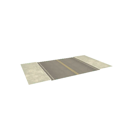
Asset Overview
Landscape around the lower Zarqa river valley, from the foothills of the West Bank to the Jordan Highlands, including the Jordan Valley, the Ghor al-Urdun. In the center of the map the Tulul adh-Dhahab (https://en.wikipedia.org/wiki/Tulul_adh-Dhahab).
* Generator: [DEM Net Elevation API](https://elevationapi.com)
* Digital Elevation Model: [SRTM_GL1 OpenTopography](https://opentopography.org/)
* Imagery: [MapBox Satellite](https://www.mapbox.com)