Select or drop a image or 3D model here to search.
We support JPG, JPEG, PNG, GIF, WEBP, GLB, OBJ, STL, FBX. More formats will be added in the future.
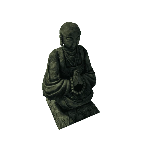
Asset Overview
This statue was scanned using a DIY direct georefencing 3D-scanner as shown in this youtube-video:
https://www.youtube.com/watch?v=WE_fD6qsLKQ
If you are interested in this tech, please take a look at the video and it's description.
Source data used to generate this (relevant GNSS-data, point cloud, rasters and MeshLab project) can be found here: https://github.com/GNSS-Stylist/3D_Scan_HareStatue There's also a project made with Godot game engine included you can use to see the scanning process.
Despite the scan being "georeferenced", this one can't be located/oriented into it's original position since the RTK-base station (=reference position) was placed in a position that wasn't recorded. And the origin of the statue was lost in post-processing.
I didn't pay too much attention to texturing so this looks a bit fuzzy. Textures were taken from the "overlaid" video seen on the youtube-clip and oriented onto the model in MeshLab by hand.
Statue is about 35 cm (or just over a foot) high. Scale: 1 unit = 1 m.