Select or drop a image or 3D model here to search.
We support JPG, JPEG, PNG, GIF, WEBP, GLB, OBJ, STL, FBX. More formats will be added in the future.
Asset Overview
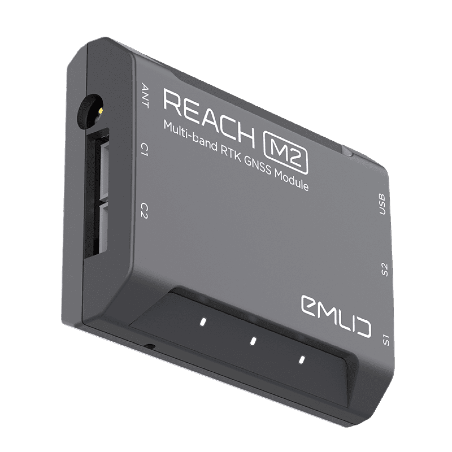
RTK GNSS module for UAV mapping
Positioning with centimeter accuracy in RTK and PPK.
For precise UAV mapping with less GCPs
more informations : https://www.ingen-geosciences.com/en/page-boutique-emlid-accessories/
*Module GNSS RTK pour la cartographie par drone
Positionnement avec une précision centimétrique en RTK et PPK.
Pour une cartographie précise par drone avec moins de GCPs.
plus d'informations : https://www.ingen-geosciences.com/page-boutique-emlid-accessories/*
INGEN is the official supplier of EMLID in France
*INGEN est le fournisseur officiel d'EMLID en France*