Select or drop a image or 3D model here to search.
We support JPG, JPEG, PNG, GIF, WEBP, GLB, OBJ, STL, FBX. More formats will be added in the future.
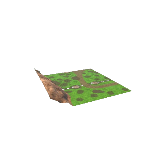
\nThis pack includes everything you will need to build large scale forest and nature scenes. With over 180 models you can create lush meadows, campsites, wooded forests, snowy hill tops and much more!
\nThe pack features a full demo scene for you to get started right away. \n
\n
\nCheck out our other Low Poly packs, you might like them as well!","fileSize":"3081500","id":274895851769,"images":{"default":{"featured":[{"href":"https://models-cdn.yahaha.com/00058300/snow_slope_2/Screenshots/snow_slope_2_20.png"},{"href":"https://models-cdn.yahaha.com/00058300/snow_slope_2/Screenshots/snow_slope_2_50.png"},{"href":"https://models-cdn.yahaha.com/00058300/snow_slope_2/Screenshots/snow_slope_2_80.png"},{"href":"https://models-cdn.yahaha.com/00058300/snow_slope_2/Screenshots/snow_slope_2_110.png"},{"href":"https://models-cdn.yahaha.com/00058300/snow_slope_2/Screenshots/snow_slope_2_140.png"},{"href":"https://models-cdn.yahaha.com/00058300/snow_slope_2/Screenshots/snow_slope_2_170.png"},{"href":"https://models-cdn.yahaha.com/00058300/snow_slope_2/Screenshots/snow_slope_2_200.png"},{"href":"https://models-cdn.yahaha.com/00058300/snow_slope_2/Screenshots/snow_slope_2_230.png"},{"href":"https://models-cdn.yahaha.com/00058300/snow_slope_2/Screenshots/snow_slope_2_260.png"},{"href":"https://models-cdn.yahaha.com/00058300/snow_slope_2/Screenshots/snow_slope_2_290.png"},{"href":"https://models-cdn.yahaha.com/00058300/snow_slope_2/Screenshots/snow_slope_2_320.png"},{"href":"https://models-cdn.yahaha.com/00058300/snow_slope_2/Screenshots/snow_slope_2_350.png"}],"main":{"href":"https://models-cdn.yahaha.com/00058300/snow_slope_2/snow_slope_2.png"}}},"license":{"name":"Standard Unity Asset Store EULA","slug":"unity_standard","url":"https://unity.com/legal/as-terms"},"modelCreatedTime":"2016-03-28T22:16:22Z","modelUpdatedTime":"2020-03-19T09:47:48Z","modelUrl":"https://models-cdn.yahaha.com/00058300/snow_slope_2.obs.glb","name":"snow_slope_2","originSource":"ASSET_STORE","packageId":"58300","packageInfo":{"icon":"//assetstorev1-prd-cdn.unity3d.com/key-image/5df6011f-7c5c-43e0-9f6a-026f40fec427.webp","name":"Low Poly National Park - Forest, Campsite, Meadow, Snow"},"polygonCount":512,"publishedDate":null,"publisher":{"name":"MultiFlagStudios"},"rigged":false,"slug":"snow_slope_2-274895851769","sourceUrl":"https://assetstore.unity.com/packages/slug/58300?aid=1011loDfK","stats":{"viewCount":1},"tags":["Low Poly National Park - Forest"," Campsite"," Meadow"," Snow","low poly","national park","Forest","Campsite","River","Meadow","Snow","Mountain","green","optimized texture"],"unityVersions":["5.3.1"],"vertexCount":0},{"animatedCount":0,"categories":[{"id":9999,"name":"Others","slug":"miscs"}],"colors":["gray","blue","cyan"],"description":"* [Helladic.info Link](http://helladic.info/DEV/MAP/MAPC/pkey_report_wparam.php?place=C5538)\r\n* Data: [Myceanean Atlas Project](https://helladic.info)\r\n* Generator: [DEM Net Elevation API](https://elevationapi.com)\r\n* Elevation: [NASADEM](https://doi.org/10.5067/MEaSUREs/NASADEM/NASADEM_HGT.001)\r\n* Data: OpenStreetMap and Contributors [www.openstreetmap.org](https://www.openstreetmap.org)\r\n* Imagery: [ThunderForest](https://www.thunderforest.com)","downloadable":true,"embedUrl":"https://sketchfab.com/models/00a328e7a48046d78bd622b45a63b1c5/embed","fileSize":287528,"free":true,"id":274893835554,"images":{"default":{"featured":[{"href":"https://models-cdn.yahaha.com/objaverse/00a328e7a48046d78bd622b45a63b1c5/images/9d815500214b45d6889e0e09e0443958.jpeg"},{"href":"https://models-cdn.yahaha.com/objaverse/00a328e7a48046d78bd622b45a63b1c5/images/40cbb307905c4753b74f9cdd70d8d128.jpeg"},{"href":"https://models-cdn.yahaha.com/objaverse/00a328e7a48046d78bd622b45a63b1c5/images/d93b3c6d7598402daacde58657e783d6.jpeg"},{"href":"https://models-cdn.yahaha.com/objaverse/00a328e7a48046d78bd622b45a63b1c5/images/646338a1ec224b898f3b79ce8f47ffc0.jpeg"},{"href":"https://models-cdn.yahaha.com/objaverse/00a328e7a48046d78bd622b45a63b1c5/images/b45e28e884074fb1a97ac23a8b5bb2ca.jpeg"}],"main":{"href":"https://models-cdn.yahaha.com/objaverse/00a328e7a48046d78bd622b45a63b1c5/images/d93b3c6d7598402daacde58657e783d6.jpeg"}}},"license":{"name":"CC BY-NC-SA 4.0","slug":"by-nc-sa","url":"https://creativecommons.org/licenses/by-nc-sa/4.0/"},"modelCreatedTime":"2020-04-07T13:16:10Z","modelUpdatedTime":"2020-04-07T13:16:10Z","name":"C5538 Pseira","originSource":"SKETCHFAB","packageId":"00a328e7a48046d78bd622b45a63b1c5","polygonCount":4100,"publishedDate":"2020-04-07T13:16:10Z","publisher":{"avatar":"https://media.sketchfab.com/avatars/3be4602927af4d07a871ac67f94cad56/671d0df0e4b3474a92598dac781f9fd0.jpeg","name":"Mycenaean Atlas Project","profileUrl":"https://sketchfab.com/mycenaean-atlas-project"},"rigged":false,"slug":"c5538_pseira-274893835554","sourceUrl":"https://sketchfab.com/3d-models/00a328e7a48046d78bd622b45a63b1c5","stats":{"viewCount":3},"tags":["elevationapi","mycenaean-atlas"],"vertexCount":2142},{"animatedCount":0,"categories":[{"id":9999,"name":"Others","slug":"miscs"}],"colors":["gray","blue","cyan"],"description":"* [Helladic.info Link](http://helladic.info/DEV/MAP/MAPC/pkey_report_wparam.php?place=C1275)\r\n* Data: [Myceanean Atlas Project](https://helladic.info)\r\n* Generator: [DEM Net Elevation API](https://elevationapi.com)\r\n* Elevation: [NASADEM](https://doi.org/10.5067/MEaSUREs/NASADEM/NASADEM_HGT.001)\r\n* Data: OpenStreetMap and Contributors [www.openstreetmap.org](https://www.openstreetmap.org)\r\n* Imagery: [ThunderForest](https://www.thunderforest.com)","downloadable":true,"embedUrl":"https://sketchfab.com/models/5d63e7b72a3d41fb932f972236c984a4/embed","fileSize":634520,"free":true,"id":274892942211,"images":{"default":{"featured":[{"href":"https://models-cdn.yahaha.com/objaverse/5d63e7b72a3d41fb932f972236c984a4/images/aa3d37a641d44e258225e3566d3349cb.jpeg"},{"href":"https://models-cdn.yahaha.com/objaverse/5d63e7b72a3d41fb932f972236c984a4/images/5034828fb57941efa4e317c8db9371a8.jpeg"},{"href":"https://models-cdn.yahaha.com/objaverse/5d63e7b72a3d41fb932f972236c984a4/images/59feba0fd4f14c3ba098f34c0904b23a.jpeg"},{"href":"https://models-cdn.yahaha.com/objaverse/5d63e7b72a3d41fb932f972236c984a4/images/57656d2cb4414fe6b68d390e1425b0af.jpeg"},{"href":"https://models-cdn.yahaha.com/objaverse/5d63e7b72a3d41fb932f972236c984a4/images/e23950c3598d4d8ab49587aaa5de3c40.jpeg"}],"main":{"href":"https://models-cdn.yahaha.com/objaverse/5d63e7b72a3d41fb932f972236c984a4/images/59feba0fd4f14c3ba098f34c0904b23a.jpeg"}}},"license":{"name":"CC BY-NC-SA 4.0","slug":"by-nc-sa","url":"https://creativecommons.org/licenses/by-nc-sa/4.0/"},"modelCreatedTime":"2020-04-04T14:22:50Z","modelUpdatedTime":"2020-04-04T14:22:50Z","name":"C1275 Mikrothivai: Phthiotic Thebes","originSource":"SKETCHFAB","packageId":"5d63e7b72a3d41fb932f972236c984a4","polygonCount":3822,"publishedDate":"2020-04-04T14:22:50Z","publisher":{"avatar":"https://media.sketchfab.com/avatars/3be4602927af4d07a871ac67f94cad56/671d0df0e4b3474a92598dac781f9fd0.jpeg","name":"Mycenaean Atlas Project","profileUrl":"https://sketchfab.com/mycenaean-atlas-project"},"rigged":false,"slug":"c1275_mikrothivai_phthiotic_thebes-274892942211","sourceUrl":"https://sketchfab.com/3d-models/5d63e7b72a3d41fb932f972236c984a4","stats":{"viewCount":7},"tags":["elevationapi","mycenaean-atlas"],"vertexCount":2000},{"animatedCount":0,"categories":[{"id":9999,"name":"Others","slug":"miscs"}],"colors":["gray","blue","cyan","purple","red","brown"],"description":"* [Helladic.info Link](http://helladic.info/DEV/MAP/MAPC/pkey_report_wparam.php?place=C5744)\r\n* Data: [Myceanean Atlas Project](https://helladic.info)\r\n* Generator: [DEM Net Elevation API](https://elevationapi.com)\r\n* Elevation: [NASADEM](https://doi.org/10.5067/MEaSUREs/NASADEM/NASADEM_HGT.001)\r\n* Data: OpenStreetMap and Contributors [www.openstreetmap.org](https://www.openstreetmap.org)\r\n* Imagery: [ThunderForest](https://www.thunderforest.com)","downloadable":true,"embedUrl":"https://sketchfab.com/models/91ded3803cea4550b90e9c7b39a4c578/embed","fileSize":434312,"free":true,"id":274894454170,"images":{"default":{"featured":[{"href":"https://models-cdn.yahaha.com/objaverse/91ded3803cea4550b90e9c7b39a4c578/images/ca24f0b013c444b9b7ac9e84aa281701.jpeg"},{"href":"https://models-cdn.yahaha.com/objaverse/91ded3803cea4550b90e9c7b39a4c578/images/182bfa15c40746fd9d463621d5870bc2.jpeg"},{"href":"https://models-cdn.yahaha.com/objaverse/91ded3803cea4550b90e9c7b39a4c578/images/a3a9c05b197d4e9e9641977abe6754cc.jpeg"},{"href":"https://models-cdn.yahaha.com/objaverse/91ded3803cea4550b90e9c7b39a4c578/images/45ec0f6ed470449aae9210aa0fbdc55b.jpeg"},{"href":"https://models-cdn.yahaha.com/objaverse/91ded3803cea4550b90e9c7b39a4c578/images/d3bc182e51e14a41997dbd72815af4d0.jpeg"}],"main":{"href":"https://models-cdn.yahaha.com/objaverse/91ded3803cea4550b90e9c7b39a4c578/images/a3a9c05b197d4e9e9641977abe6754cc.jpeg"}}},"license":{"name":"CC BY-NC-SA 4.0","slug":"by-nc-sa","url":"https://creativecommons.org/licenses/by-nc-sa/4.0/"},"modelCreatedTime":"2020-04-06T23:57:16Z","modelUpdatedTime":"2020-04-06T23:57:16Z","name":"C5744 Kalami: Chamber Tomb: 1969","originSource":"SKETCHFAB","packageId":"91ded3803cea4550b90e9c7b39a4c578","polygonCount":4371,"publishedDate":"2020-04-06T23:57:16Z","publisher":{"avatar":"https://media.sketchfab.com/avatars/3be4602927af4d07a871ac67f94cad56/671d0df0e4b3474a92598dac781f9fd0.jpeg","name":"Mycenaean Atlas Project","profileUrl":"https://sketchfab.com/mycenaean-atlas-project"},"rigged":false,"slug":"c5744_kalami_chamber_tomb_1969-274894454170","sourceUrl":"https://sketchfab.com/3d-models/91ded3803cea4550b90e9c7b39a4c578","stats":{"viewCount":3},"tags":["elevationapi","mycenaean-atlas"],"vertexCount":2378},{"animatedCount":0,"categories":[{"id":9999,"name":"Others","slug":"miscs"}],"colors":[],"description":"* [Helladic.info Link](http://helladic.info/DEV/MAP/MAPC/pkey_report_wparam.php?place=C975)\r\n* Data: [Myceanean Atlas Project](https://helladic.info)\r\n* Generator: [DEM Net Elevation API](https://elevationapi.com)\r\n* Elevation: [NASADEM](https://doi.org/10.5067/MEaSUREs/NASADEM/NASADEM_HGT.001)\r\n* Data: OpenStreetMap and Contributors [www.openstreetmap.org](https://www.openstreetmap.org)\r\n* Imagery: [ThunderForest](https://www.thunderforest.com)","downloadable":true,"embedUrl":"https://sketchfab.com/models/6d81eab2bded42a1bdbbb4961c48e64d/embed","fileSize":548296,"free":true,"id":274893297716,"images":{"default":{"featured":[{"href":"https://models-cdn.yahaha.com/objaverse/6d81eab2bded42a1bdbbb4961c48e64d/images/dea4878b73924061bc1eb6b472bfbecd.jpeg"},{"href":"https://models-cdn.yahaha.com/objaverse/6d81eab2bded42a1bdbbb4961c48e64d/images/942f609e12fd4f3d9f042c36c86e97e8.jpeg"},{"href":"https://models-cdn.yahaha.com/objaverse/6d81eab2bded42a1bdbbb4961c48e64d/images/a42898e079394f03b9fdcf09a5d508e6.jpeg"},{"href":"https://models-cdn.yahaha.com/objaverse/6d81eab2bded42a1bdbbb4961c48e64d/images/779d019276444a91b8547ecad55760dc.jpeg"},{"href":"https://models-cdn.yahaha.com/objaverse/6d81eab2bded42a1bdbbb4961c48e64d/images/772551ee4fd8413c8d056a8e440153ab.jpeg"}],"main":{"href":"https://models-cdn.yahaha.com/objaverse/6d81eab2bded42a1bdbbb4961c48e64d/images/a42898e079394f03b9fdcf09a5d508e6.jpeg"}}},"license":{"name":"CC BY-NC-SA 4.0","slug":"by-nc-sa","url":"https://creativecommons.org/licenses/by-nc-sa/4.0/"},"modelCreatedTime":"2020-04-07T14:59:39Z","modelUpdatedTime":"2020-04-07T14:59:39Z","name":"C975 Aspis: Hab east","originSource":"SKETCHFAB","packageId":"6d81eab2bded42a1bdbbb4961c48e64d","polygonCount":4050,"publishedDate":"2020-04-07T14:59:39Z","publisher":{"avatar":"https://media.sketchfab.com/avatars/3be4602927af4d07a871ac67f94cad56/671d0df0e4b3474a92598dac781f9fd0.jpeg","name":"Mycenaean Atlas Project","profileUrl":"https://sketchfab.com/mycenaean-atlas-project"},"rigged":false,"slug":"c975_aspis_hab_east-274893297716","sourceUrl":"https://sketchfab.com/3d-models/6d81eab2bded42a1bdbbb4961c48e64d","stats":{"viewCount":2},"tags":["elevationapi","mycenaean-atlas"],"vertexCount":2127},{"animatedCount":0,"categories":[{"id":9999,"name":"Others","slug":"miscs"}],"colors":[],"description":"* [Helladic.info Link](http://helladic.info/DEV/MAP/MAPC/pkey_report_wparam.php?place=C5520)\r\n* Data: [Myceanean Atlas Project](https://helladic.info)\r\n* Generator: [DEM Net Elevation API](https://elevationapi.com)\r\n* Elevation: [NASADEM](https://doi.org/10.5067/MEaSUREs/NASADEM/NASADEM_HGT.001)\r\n* Data: OpenStreetMap and Contributors [www.openstreetmap.org](https://www.openstreetmap.org)\r\n* Imagery: [ThunderForest](https://www.thunderforest.com)","downloadable":true,"embedUrl":"https://sketchfab.com/models/7369ceafe6c64744a4b33a19413194d1/embed","fileSize":262728,"free":true,"id":274894602153,"images":{"default":{"featured":[{"href":"https://models-cdn.yahaha.com/objaverse/7369ceafe6c64744a4b33a19413194d1/images/4eccf2dc4e9c4d44aa7a6cc6a8beedff.jpeg"},{"href":"https://models-cdn.yahaha.com/objaverse/7369ceafe6c64744a4b33a19413194d1/images/07aa63bcff3f43b688d54edddbee5c78.jpeg"},{"href":"https://models-cdn.yahaha.com/objaverse/7369ceafe6c64744a4b33a19413194d1/images/aba370e40bac4a1b80226949e4598254.jpeg"},{"href":"https://models-cdn.yahaha.com/objaverse/7369ceafe6c64744a4b33a19413194d1/images/61ce147d14d0472e8b7f1722d5c6738f.jpeg"},{"href":"https://models-cdn.yahaha.com/objaverse/7369ceafe6c64744a4b33a19413194d1/images/0eae35b532f74ebcb3a137ef722b74a5.jpeg"}],"main":{"href":"https://models-cdn.yahaha.com/objaverse/7369ceafe6c64744a4b33a19413194d1/images/aba370e40bac4a1b80226949e4598254.jpeg"}}},"license":{"name":"CC BY-NC-SA 4.0","slug":"by-nc-sa","url":"https://creativecommons.org/licenses/by-nc-sa/4.0/"},"modelCreatedTime":"2020-04-07T13:15:04Z","modelUpdatedTime":"2020-04-07T13:15:04Z","name":"C5520 Alagni: Panaghia/Vryssi","originSource":"SKETCHFAB","packageId":"7369ceafe6c64744a4b33a19413194d1","polygonCount":4100,"publishedDate":"2020-04-07T13:15:04Z","publisher":{"avatar":"https://media.sketchfab.com/avatars/3be4602927af4d07a871ac67f94cad56/671d0df0e4b3474a92598dac781f9fd0.jpeg","name":"Mycenaean Atlas Project","profileUrl":"https://sketchfab.com/mycenaean-atlas-project"},"rigged":false,"slug":"c5520_alagni_panaghia_vryssi-274894602153","sourceUrl":"https://sketchfab.com/3d-models/7369ceafe6c64744a4b33a19413194d1","stats":{"viewCount":1},"tags":["elevationapi","mycenaean-atlas"],"vertexCount":2142},{"animatedCount":0,"categories":[{"id":9999,"name":"Others","slug":"miscs"}],"colors":["gray","blue","cyan"],"description":"* [Helladic.info Link](http://helladic.info/DEV/MAP/MAPC/pkey_report_wparam.php?place=C879)\r\n* Data: [Myceanean Atlas Project](https://helladic.info)\r\n* Generator: [DEM Net Elevation API](https://elevationapi.com)\r\n* Elevation: [NASADEM](https://doi.org/10.5067/MEaSUREs/NASADEM/NASADEM_HGT.001)\r\n* Data: OpenStreetMap and Contributors [www.openstreetmap.org](https://www.openstreetmap.org)\r\n* Imagery: [ThunderForest](https://www.thunderforest.com)","downloadable":true,"embedUrl":"https://sketchfab.com/models/25410f1279a14ce5a9488f58610e19e1/embed","fileSize":309144,"free":true,"id":274893522886,"images":{"default":{"featured":[{"href":"https://models-cdn.yahaha.com/objaverse/25410f1279a14ce5a9488f58610e19e1/images/57d4c5a79796486ab8400b77ce61048e.jpeg"},{"href":"https://models-cdn.yahaha.com/objaverse/25410f1279a14ce5a9488f58610e19e1/images/50297a9f9cc8454eb187e895810d74e3.jpeg"},{"href":"https://models-cdn.yahaha.com/objaverse/25410f1279a14ce5a9488f58610e19e1/images/e4775201a2db4fd08fb280ac9d9382e9.jpeg"},{"href":"https://models-cdn.yahaha.com/objaverse/25410f1279a14ce5a9488f58610e19e1/images/5df480ffc96346c88dee467686a6f12b.jpeg"},{"href":"https://models-cdn.yahaha.com/objaverse/25410f1279a14ce5a9488f58610e19e1/images/d9314b83871b4649b9eeee3e780ca2f2.jpeg"}],"main":{"href":"https://models-cdn.yahaha.com/objaverse/25410f1279a14ce5a9488f58610e19e1/images/e4775201a2db4fd08fb280ac9d9382e9.jpeg"}}},"license":{"name":"CC BY-NC-SA 4.0","slug":"by-nc-sa","url":"https://creativecommons.org/licenses/by-nc-sa/4.0/"},"modelCreatedTime":"2020-04-07T03:01:18Z","modelUpdatedTime":"2020-04-07T03:01:18Z","name":"C879 Myloi: MH Cem","originSource":"SKETCHFAB","packageId":"25410f1279a14ce5a9488f58610e19e1","polygonCount":3966,"publishedDate":"2020-04-07T03:01:18Z","publisher":{"avatar":"https://media.sketchfab.com/avatars/3be4602927af4d07a871ac67f94cad56/671d0df0e4b3474a92598dac781f9fd0.jpeg","name":"Mycenaean Atlas Project","profileUrl":"https://sketchfab.com/mycenaean-atlas-project"},"rigged":false,"slug":"c879_myloi_mh_cem-274893522886","sourceUrl":"https://sketchfab.com/3d-models/25410f1279a14ce5a9488f58610e19e1","stats":{"viewCount":14},"tags":["elevationapi","mycenaean-atlas"],"vertexCount":2092},{"animatedCount":0,"categories":[{"id":9999,"name":"Others","slug":"miscs"}],"colors":[],"description":"* [Helladic.info Link](http://helladic.info/DEV/MAP/MAPC/pkey_report_wparam.php?place=C1601)\r\n* Data: [Myceanean Atlas Project](https://helladic.info)\r\n* Generator: [DEM Net Elevation API](https://elevationapi.com)\r\n* Elevation: [NASADEM](https://doi.org/10.5067/MEaSUREs/NASADEM/NASADEM_HGT.001)\r\n* Data: OpenStreetMap and Contributors [www.openstreetmap.org](https://www.openstreetmap.org)\r\n* Imagery: [ThunderForest](https://www.thunderforest.com)","downloadable":true,"embedUrl":"https://sketchfab.com/models/57b8d78ddabf4661a0f9b009c542cacc/embed","fileSize":483792,"free":true,"id":274894307030,"images":{"default":{"featured":[{"href":"https://models-cdn.yahaha.com/objaverse/57b8d78ddabf4661a0f9b009c542cacc/images/7a69bf2bbc39417ca4505200c048a4cf.jpeg"},{"href":"https://models-cdn.yahaha.com/objaverse/57b8d78ddabf4661a0f9b009c542cacc/images/23930f0857f542ac80287757564facdf.jpeg"},{"href":"https://models-cdn.yahaha.com/objaverse/57b8d78ddabf4661a0f9b009c542cacc/images/641d4e5689774e7ab2513d2570922502.jpeg"},{"href":"https://models-cdn.yahaha.com/objaverse/57b8d78ddabf4661a0f9b009c542cacc/images/6640bfa9693247ec9e1548971f9563d7.jpeg"},{"href":"https://models-cdn.yahaha.com/objaverse/57b8d78ddabf4661a0f9b009c542cacc/images/2e3c90fbb42c450a86c35c7c1d4e2b07.jpeg"}],"main":{"href":"https://models-cdn.yahaha.com/objaverse/57b8d78ddabf4661a0f9b009c542cacc/images/641d4e5689774e7ab2513d2570922502.jpeg"}}},"license":{"name":"CC BY 4.0","slug":"by","url":"https://creativecommons.org/licenses/by/4.0/"},"modelCreatedTime":"2020-04-04T18:47:13Z","modelUpdatedTime":"2020-04-04T18:47:13Z","name":"C1601 Exarchos: Hyampolis","originSource":"SKETCHFAB","packageId":"57b8d78ddabf4661a0f9b009c542cacc","polygonCount":3900,"publishedDate":"2020-04-04T18:47:13Z","publisher":{"avatar":"https://media.sketchfab.com/avatars/3be4602927af4d07a871ac67f94cad56/671d0df0e4b3474a92598dac781f9fd0.jpeg","name":"Mycenaean Atlas Project","profileUrl":"https://sketchfab.com/mycenaean-atlas-project"},"rigged":false,"slug":"c1601_exarchos_hyampolis-274894307030","sourceUrl":"https://sketchfab.com/3d-models/57b8d78ddabf4661a0f9b009c542cacc","stats":{"viewCount":1},"tags":["elevationapi","mycenaean-atlas"],"vertexCount":2040},{"animatedCount":0,"categories":[{"id":9999,"name":"Others","slug":"miscs"}],"colors":[],"description":"* [Helladic.info Link](http://helladic.info/DEV/MAP/MAPC/pkey_report_wparam.php?place=C3722)\r\n* Data: [Myceanean Atlas Project](https://helladic.info)\r\n* Generator: [DEM Net Elevation API](https://elevationapi.com)\r\n* Elevation: [NASADEM](https://doi.org/10.5067/MEaSUREs/NASADEM/NASADEM_HGT.001)\r\n* Data: OpenStreetMap and Contributors [www.openstreetmap.org](https://www.openstreetmap.org)\r\n* Imagery: [ThunderForest](https://www.thunderforest.com)","downloadable":true,"embedUrl":"https://sketchfab.com/models/a898f1c8ef454e2ebdb400df25851366/embed","fileSize":268916,"free":true,"id":274894439350,"images":{"default":{"featured":[{"href":"https://models-cdn.yahaha.com/objaverse/a898f1c8ef454e2ebdb400df25851366/images/fde966ede2044049b08b2893eec9bbab.jpeg"},{"href":"https://models-cdn.yahaha.com/objaverse/a898f1c8ef454e2ebdb400df25851366/images/453adfad51ee4265a95e81c58f6bca3a.jpeg"},{"href":"https://models-cdn.yahaha.com/objaverse/a898f1c8ef454e2ebdb400df25851366/images/a461afac8354454d8efc7460f507b305.jpeg"},{"href":"https://models-cdn.yahaha.com/objaverse/a898f1c8ef454e2ebdb400df25851366/images/6299816d1ca24e12ad41835925ace202.jpeg"},{"href":"https://models-cdn.yahaha.com/objaverse/a898f1c8ef454e2ebdb400df25851366/images/28de12ca24ad4660b611dc8253b9becb.jpeg"}],"main":{"href":"https://models-cdn.yahaha.com/objaverse/a898f1c8ef454e2ebdb400df25851366/images/a461afac8354454d8efc7460f507b305.jpeg"}}},"license":{"name":"CC BY-NC-SA 4.0","slug":"by-nc-sa","url":"https://creativecommons.org/licenses/by-nc-sa/4.0/"},"modelCreatedTime":"2020-04-06T21:27:49Z","modelUpdatedTime":"2020-04-06T21:27:49Z","name":"C3722 Kameroti","originSource":"SKETCHFAB","packageId":"a898f1c8ef454e2ebdb400df25851366","polygonCount":3822,"publishedDate":"2020-04-06T21:27:49Z","publisher":{"avatar":"https://media.sketchfab.com/avatars/3be4602927af4d07a871ac67f94cad56/671d0df0e4b3474a92598dac781f9fd0.jpeg","name":"Mycenaean Atlas Project","profileUrl":"https://sketchfab.com/mycenaean-atlas-project"},"rigged":false,"slug":"c3722_kameroti-274894439350","sourceUrl":"https://sketchfab.com/3d-models/a898f1c8ef454e2ebdb400df25851366","stats":{"viewCount":2},"tags":["elevationapi","mycenaean-atlas"],"vertexCount":2000},{"animatedCount":0,"categories":[{"id":1,"name":"Architecture","slug":"architecture"}],"colors":["gray","orange","yellow","cyan","brown","red"],"description":"Small water fountain.","downloadable":true,"embedUrl":"https://sketchfab.com/models/7c60346654854fb7b79d4af9abfe65ed/embed","fileSize":4275892,"free":true,"id":274892746604,"images":{"default":{"featured":[{"href":"https://models-cdn.yahaha.com/objaverse/7c60346654854fb7b79d4af9abfe65ed/images/8c799001de1d4c2da21e38b803a37b09.jpeg"},{"href":"https://models-cdn.yahaha.com/objaverse/7c60346654854fb7b79d4af9abfe65ed/images/51a977143658408a80f0471574223153.jpeg"},{"href":"https://models-cdn.yahaha.com/objaverse/7c60346654854fb7b79d4af9abfe65ed/images/e526a2d3a25d4658808cfa6b05b054d3.jpeg"},{"href":"https://models-cdn.yahaha.com/objaverse/7c60346654854fb7b79d4af9abfe65ed/images/97aed85bd62f4268a685fee6395f9910.jpeg"},{"href":"https://models-cdn.yahaha.com/objaverse/7c60346654854fb7b79d4af9abfe65ed/images/d4602ad8e652488095170345bafbd7b4.jpeg"}],"main":{"href":"https://models-cdn.yahaha.com/objaverse/7c60346654854fb7b79d4af9abfe65ed/images/e526a2d3a25d4658808cfa6b05b054d3.jpeg"}}},"license":{"name":"CC BY 4.0","slug":"by","url":"https://creativecommons.org/licenses/by/4.0/"},"modelCreatedTime":"2020-04-06T12:01:57Z","modelUpdatedTime":"2020-04-06T12:01:57Z","name":"Bica","originSource":"SKETCHFAB","packageId":"7c60346654854fb7b79d4af9abfe65ed","polygonCount":98143,"publishedDate":"2020-04-06T12:01:57Z","publisher":{"avatar":"https://media.sketchfab.com/avatars/22ea38ffc67a43cead0fad571313b980/d17404f8464c40d19357f97f67401c96.jpeg","name":"Artur Coelho","profileUrl":"https://sketchfab.com/coelhoelectrico"},"rigged":false,"slug":"bica-274892746604","sourceUrl":"https://sketchfab.com/3d-models/7c60346654854fb7b79d4af9abfe65ed","stats":{"viewCount":2},"tags":["android","photogrammetry","displayland"],"vertexCount":49348},{"animatedCount":0,"categories":[{"id":9999,"name":"Others","slug":"miscs"}],"colors":[],"description":"* [Helladic.info Link](http://helladic.info/DEV/MAP/MAPC/pkey_report_wparam.php?place=C984)\r\n* Data: [Myceanean Atlas Project](https://helladic.info)\r\n* Generator: [DEM Net Elevation API](https://elevationapi.com)\r\n* Elevation: [NASADEM](https://doi.org/10.5067/MEaSUREs/NASADEM/NASADEM_HGT.001)\r\n* Data: OpenStreetMap and Contributors [www.openstreetmap.org](https://www.openstreetmap.org)\r\n* Imagery: [ThunderForest](https://www.thunderforest.com)","downloadable":true,"embedUrl":"https://sketchfab.com/models/e2d5de728d704e84a04efb063390350a/embed","fileSize":532312,"free":true,"id":274894608953,"images":{"default":{"featured":[{"href":"https://models-cdn.yahaha.com/objaverse/e2d5de728d704e84a04efb063390350a/images/061ae55bff3947e4a41b53e4e3a4c6e9.jpeg"},{"href":"https://models-cdn.yahaha.com/objaverse/e2d5de728d704e84a04efb063390350a/images/548d15b4eca34657b17ce59acbcc3e04.jpeg"},{"href":"https://models-cdn.yahaha.com/objaverse/e2d5de728d704e84a04efb063390350a/images/2cba912b98da4e98a1306accd6ddba45.jpeg"},{"href":"https://models-cdn.yahaha.com/objaverse/e2d5de728d704e84a04efb063390350a/images/cbea6f62ce4b4aef964cee4f2dec74d7.jpeg"},{"href":"https://models-cdn.yahaha.com/objaverse/e2d5de728d704e84a04efb063390350a/images/7fd7bd1fad274e6aa679fd66b24221c7.jpeg"}],"main":{"href":"https://models-cdn.yahaha.com/objaverse/e2d5de728d704e84a04efb063390350a/images/2cba912b98da4e98a1306accd6ddba45.jpeg"}}},"license":{"name":"CC BY-NC-SA 4.0","slug":"by-nc-sa","url":"https://creativecommons.org/licenses/by-nc-sa/4.0/"},"modelCreatedTime":"2020-04-07T10:41:22Z","modelUpdatedTime":"2020-04-07T10:41:22Z","name":"C984 Magoula Kavkala","originSource":"SKETCHFAB","packageId":"e2d5de728d704e84a04efb063390350a","polygonCount":3822,"publishedDate":"2020-04-07T10:41:22Z","publisher":{"avatar":"https://media.sketchfab.com/avatars/3be4602927af4d07a871ac67f94cad56/671d0df0e4b3474a92598dac781f9fd0.jpeg","name":"Mycenaean Atlas Project","profileUrl":"https://sketchfab.com/mycenaean-atlas-project"},"rigged":false,"slug":"c984_magoula_kavkala-274894608953","sourceUrl":"https://sketchfab.com/3d-models/e2d5de728d704e84a04efb063390350a","stats":{"viewCount":3},"tags":["elevationapi","mycenaean-atlas"],"vertexCount":2000},{"animatedCount":0,"categories":[{"id":9999,"name":"Others","slug":"miscs"}],"colors":["gray","black","cyan","brown"],"description":"Created with Polycam","downloadable":true,"embedUrl":"https://sketchfab.com/models/339c5dcd1c754c6ba98411c9bb69459e/embed","fileSize":3410088,"free":true,"id":274893194723,"images":{"default":{"featured":[{"href":"https://models-cdn.yahaha.com/objaverse/339c5dcd1c754c6ba98411c9bb69459e/images/cdf7bee57a4447ea84a9e0d8144c2f36.jpeg"},{"href":"https://models-cdn.yahaha.com/objaverse/339c5dcd1c754c6ba98411c9bb69459e/images/ee4b669a17074651ab1e6a053c22bec4.jpeg"},{"href":"https://models-cdn.yahaha.com/objaverse/339c5dcd1c754c6ba98411c9bb69459e/images/cde082ecd4c244e5824d049c884e09ae.jpeg"},{"href":"https://models-cdn.yahaha.com/objaverse/339c5dcd1c754c6ba98411c9bb69459e/images/44a6b5a19ab94e99880f434353ca8cc5.jpeg"},{"href":"https://models-cdn.yahaha.com/objaverse/339c5dcd1c754c6ba98411c9bb69459e/images/e83292b67b604f6daef8626008bc278e.jpeg"}],"main":{"href":"https://models-cdn.yahaha.com/objaverse/339c5dcd1c754c6ba98411c9bb69459e/images/cde082ecd4c244e5824d049c884e09ae.jpeg"}}},"license":{"name":"CC BY-NC-SA 4.0","slug":"by-nc-sa","url":"https://creativecommons.org/licenses/by-nc-sa/4.0/"},"modelCreatedTime":"2022-02-24T10:16:14Z","modelUpdatedTime":"2022-02-24T10:16:14Z","name":"Terrarium","originSource":"SKETCHFAB","packageId":"339c5dcd1c754c6ba98411c9bb69459e","polygonCount":58322,"publishedDate":"2022-02-24T10:16:14Z","publisher":{"avatar":"https://media.sketchfab.com/avatars/78fa317e46024a5283765aa34df5e508/aec92fe9a74e499c98d759362cd7f02f.jpeg","name":"polygonwindow","profileUrl":"https://sketchfab.com/polygonwindow"},"rigged":false,"slug":"terrarium-274893194723","sourceUrl":"https://sketchfab.com/3d-models/339c5dcd1c754c6ba98411c9bb69459e","stats":{"viewCount":9},"tags":["polycam"],"vertexCount":29469},{"animatedCount":0,"categories":[{"id":9999,"name":"Others","slug":"miscs"}],"colors":["gray","blue","cyan","brown","red"],"description":"* [Helladic.info Link](http://helladic.info/DEV/MAP/MAPC/pkey_report_wparam.php?place=C1406)\r\n* Data: [Myceanean Atlas Project](https://helladic.info)\r\n* Generator: [DEM Net Elevation API](https://elevationapi.com)\r\n* Elevation: [NASADEM](https://doi.org/10.5067/MEaSUREs/NASADEM/NASADEM_HGT.001)\r\n* Data: OpenStreetMap and Contributors [www.openstreetmap.org](https://www.openstreetmap.org)\r\n* Imagery: [ThunderForest](https://www.thunderforest.com)","downloadable":true,"embedUrl":"https://sketchfab.com/models/6f9c5c3c87e8453086c52803f0e1c28d/embed","fileSize":612348,"free":true,"id":274894017332,"images":{"default":{"featured":[{"href":"https://models-cdn.yahaha.com/objaverse/6f9c5c3c87e8453086c52803f0e1c28d/images/03afdccc0ab448e880a40a32771a6015.jpeg"},{"href":"https://models-cdn.yahaha.com/objaverse/6f9c5c3c87e8453086c52803f0e1c28d/images/73f3f4dfd66a4b9dbdaf9004da72b459.jpeg"},{"href":"https://models-cdn.yahaha.com/objaverse/6f9c5c3c87e8453086c52803f0e1c28d/images/2a46b476344c4923acb2741a802fe105.jpeg"},{"href":"https://models-cdn.yahaha.com/objaverse/6f9c5c3c87e8453086c52803f0e1c28d/images/9d399cf964af4a5696db28ff67d20c77.jpeg"},{"href":"https://models-cdn.yahaha.com/objaverse/6f9c5c3c87e8453086c52803f0e1c28d/images/c47c7b10463446ea9ae84be5407fdb8d.jpeg"}],"main":{"href":"https://models-cdn.yahaha.com/objaverse/6f9c5c3c87e8453086c52803f0e1c28d/images/2a46b476344c4923acb2741a802fe105.jpeg"}}},"license":{"name":"CC BY-NC-SA 4.0","slug":"by-nc-sa","url":"https://creativecommons.org/licenses/by-nc-sa/4.0/"},"modelCreatedTime":"2020-04-04T14:44:52Z","modelUpdatedTime":"2020-04-04T14:44:52Z","name":"C1406 Diafani/Yiafani","originSource":"SKETCHFAB","packageId":"6f9c5c3c87e8453086c52803f0e1c28d","polygonCount":5099,"publishedDate":"2020-04-04T14:44:52Z","publisher":{"avatar":"https://media.sketchfab.com/avatars/3be4602927af4d07a871ac67f94cad56/671d0df0e4b3474a92598dac781f9fd0.jpeg","name":"Mycenaean Atlas Project","profileUrl":"https://sketchfab.com/mycenaean-atlas-project"},"rigged":false,"slug":"c1406_diafani_yiafani-274894017332","sourceUrl":"https://sketchfab.com/3d-models/6f9c5c3c87e8453086c52803f0e1c28d","stats":{"viewCount":2},"tags":["elevationapi","mycenaean-atlas"],"vertexCount":2886},{"animatedCount":0,"categories":[{"id":1,"name":"Architecture","slug":"architecture"}],"colors":[],"description":"An OBJ file created with 3D Scanner for Android\nThis is a rough overview of a suspected 11th century lime kiln flue, during excavation at Lindisfarne Priory, at Holy Island, Northumberland, England, UK\nExcavated on September 19th, 2021","downloadable":true,"embedUrl":"https://sketchfab.com/models/3e7ada0e13944d8b90fbde40e1b6cfd1/embed","fileSize":3606864,"free":true,"id":274893269153,"images":{"default":{"featured":[{"href":"https://models-cdn.yahaha.com/objaverse/3e7ada0e13944d8b90fbde40e1b6cfd1/images/6e401d7725454dc7a26d3c2d8e1649c0.jpeg"},{"href":"https://models-cdn.yahaha.com/objaverse/3e7ada0e13944d8b90fbde40e1b6cfd1/images/7bbc02c703984f2e8524d6cba4435cd4.jpeg"},{"href":"https://models-cdn.yahaha.com/objaverse/3e7ada0e13944d8b90fbde40e1b6cfd1/images/f74fdfaf620c4304aea5470bd087b637.jpeg"},{"href":"https://models-cdn.yahaha.com/objaverse/3e7ada0e13944d8b90fbde40e1b6cfd1/images/a5523aaffea34febbcd6b616c40445c8.jpeg"},{"href":"https://models-cdn.yahaha.com/objaverse/3e7ada0e13944d8b90fbde40e1b6cfd1/images/028cabed42c44de69ee9943f8e3f15d3.jpeg"}],"main":{"href":"https://models-cdn.yahaha.com/objaverse/3e7ada0e13944d8b90fbde40e1b6cfd1/images/f74fdfaf620c4304aea5470bd087b637.jpeg"}}},"license":{"name":"CC BY 4.0","slug":"by","url":"https://creativecommons.org/licenses/by/4.0/"},"modelCreatedTime":"2021-09-19T17:36:18Z","modelUpdatedTime":"2021-09-19T17:36:18Z","name":"2021lindisfarne Artsflue","originSource":"SKETCHFAB","packageId":"3e7ada0e13944d8b90fbde40e1b6cfd1","polygonCount":8573,"publishedDate":"2021-09-19T17:36:18Z","publisher":{"avatar":"https://media.sketchfab.com/avatars/d7b2489f3b6f40a1bb67dd330734a649/209d2a8e8482449183f256792532b321.jpeg","name":"Art Tucker","profileUrl":"https://sketchfab.com/arttucker"},"rigged":false,"slug":"2021lindisfarne_artsflue-274893269153","sourceUrl":"https://sketchfab.com/3d-models/3e7ada0e13944d8b90fbde40e1b6cfd1","stats":{"viewCount":1},"tags":["excavation","digventures","kiln","lindisfarne","photogrammetry","archaeology","lindisfarnedig"],"vertexCount":6150},{"animatedCount":0,"categories":[{"id":9999,"name":"Others","slug":"miscs"}],"colors":[],"description":"* [Helladic.info Link](http://helladic.info/DEV/MAP/MAPC/pkey_report_wparam.php?place=C5538)\r\n* Data: [Myceanean Atlas Project](https://helladic.info)\r\n* Generator: [DEM Net Elevation API](https://elevationapi.com)\r\n* Elevation: [NASADEM](https://doi.org/10.5067/MEaSUREs/NASADEM/NASADEM_HGT.001)\r\n* Data: OpenStreetMap and Contributors [www.openstreetmap.org](https://www.openstreetmap.org)\r\n* Imagery: [ThunderForest](https://www.thunderforest.com)","downloadable":true,"embedUrl":"https://sketchfab.com/models/3aa890899e8d4695a2624e907172f6dd/embed","fileSize":287528,"free":true,"id":274894058230,"images":{"default":{"featured":[{"href":"https://models-cdn.yahaha.com/objaverse/3aa890899e8d4695a2624e907172f6dd/images/dfd9c02d748f462dbcf46ba4472a9c86.jpeg"},{"href":"https://models-cdn.yahaha.com/objaverse/3aa890899e8d4695a2624e907172f6dd/images/14b2f0ae13de4f26bd870a8305f677f2.jpeg"},{"href":"https://models-cdn.yahaha.com/objaverse/3aa890899e8d4695a2624e907172f6dd/images/fe889cebfa9f4e1bac9485922c97c027.jpeg"},{"href":"https://models-cdn.yahaha.com/objaverse/3aa890899e8d4695a2624e907172f6dd/images/87e659947ca94bb5a0b0eb2b39613b5c.jpeg"},{"href":"https://models-cdn.yahaha.com/objaverse/3aa890899e8d4695a2624e907172f6dd/images/f13a1275d74049d3b6ffdad0b4e10543.jpeg"}],"main":{"href":"https://models-cdn.yahaha.com/objaverse/3aa890899e8d4695a2624e907172f6dd/images/fe889cebfa9f4e1bac9485922c97c027.jpeg"}}},"license":{"name":"CC BY-NC-SA 4.0","slug":"by-nc-sa","url":"https://creativecommons.org/licenses/by-nc-sa/4.0/"},"modelCreatedTime":"2020-04-07T08:54:28Z","modelUpdatedTime":"2020-04-07T08:54:28Z","name":"C5538 Pseira","originSource":"SKETCHFAB","packageId":"3aa890899e8d4695a2624e907172f6dd","polygonCount":4100,"publishedDate":"2020-04-07T08:54:28Z","publisher":{"avatar":"https://media.sketchfab.com/avatars/3be4602927af4d07a871ac67f94cad56/671d0df0e4b3474a92598dac781f9fd0.jpeg","name":"Mycenaean Atlas Project","profileUrl":"https://sketchfab.com/mycenaean-atlas-project"},"rigged":false,"slug":"c5538_pseira-274894058230","sourceUrl":"https://sketchfab.com/3d-models/3aa890899e8d4695a2624e907172f6dd","stats":{"viewCount":4},"tags":["elevationapi","mycenaean-atlas"],"vertexCount":2142},{"animatedCount":0,"categories":[{"id":9999,"name":"Others","slug":"miscs"}],"colors":["gray","blue","cyan","red","brown","purple"],"description":"* [Helladic.info Link](http://helladic.info/DEV/MAP/MAPC/pkey_report_wparam.php?place=C5181)\r\n* Data: [Myceanean Atlas Project](https://helladic.info)\r\n* Generator: [DEM Net Elevation API](https://elevationapi.com)\r\n* Elevation: [NASADEM](https://doi.org/10.5067/MEaSUREs/NASADEM/NASADEM_HGT.001)\r\n* Data: OpenStreetMap and Contributors [www.openstreetmap.org](https://www.openstreetmap.org)\r\n* Imagery: [ThunderForest](https://www.thunderforest.com)","downloadable":true,"embedUrl":"https://sketchfab.com/models/82b4b2993dbf48bea01fc6bf41774f0a/embed","fileSize":410736,"free":true,"id":274892751786,"images":{"default":{"featured":[{"href":"https://models-cdn.yahaha.com/objaverse/82b4b2993dbf48bea01fc6bf41774f0a/images/5f0542cc18544b1b8a919823f86ae127.jpeg"},{"href":"https://models-cdn.yahaha.com/objaverse/82b4b2993dbf48bea01fc6bf41774f0a/images/1208ea169f204574bc2cbbac11d6c84c.jpeg"},{"href":"https://models-cdn.yahaha.com/objaverse/82b4b2993dbf48bea01fc6bf41774f0a/images/3290f40a530246728b8f9a5313c74851.jpeg"},{"href":"https://models-cdn.yahaha.com/objaverse/82b4b2993dbf48bea01fc6bf41774f0a/images/0fb813a3b393488ca9fdba7929768375.jpeg"},{"href":"https://models-cdn.yahaha.com/objaverse/82b4b2993dbf48bea01fc6bf41774f0a/images/7fe30d50e36145e9a1d87fe8902b3e7d.jpeg"}],"main":{"href":"https://models-cdn.yahaha.com/objaverse/82b4b2993dbf48bea01fc6bf41774f0a/images/3290f40a530246728b8f9a5313c74851.jpeg"}}},"license":{"name":"CC BY-NC-SA 4.0","slug":"by-nc-sa","url":"https://creativecommons.org/licenses/by-nc-sa/4.0/"},"modelCreatedTime":"2020-04-06T22:36:22Z","modelUpdatedTime":"2020-04-06T22:36:22Z","name":"C5181 Themis","originSource":"SKETCHFAB","packageId":"82b4b2993dbf48bea01fc6bf41774f0a","polygonCount":3891,"publishedDate":"2020-04-06T22:36:22Z","publisher":{"avatar":"https://media.sketchfab.com/avatars/3be4602927af4d07a871ac67f94cad56/671d0df0e4b3474a92598dac781f9fd0.jpeg","name":"Mycenaean Atlas Project","profileUrl":"https://sketchfab.com/mycenaean-atlas-project"},"rigged":false,"slug":"c5181_themis-274892751786","sourceUrl":"https://sketchfab.com/3d-models/82b4b2993dbf48bea01fc6bf41774f0a","stats":{"viewCount":3},"tags":["elevationapi","mycenaean-atlas"],"vertexCount":2067},{"animatedCount":0,"categories":[{"id":5,"name":"Art & History","slug":"art-history"}],"colors":["gray","brown","red","cyan"],"description":"Laserscan of one of the carts on this panel","downloadable":true,"embedUrl":"https://sketchfab.com/models/60c38d065e2c45738c77e6537a727539/embed","fileSize":34619548,"free":true,"id":274894584886,"images":{"default":{"featured":[{"href":"https://models-cdn.yahaha.com/objaverse/60c38d065e2c45738c77e6537a727539/images/10f722e38e8f4331b18b34f469656fe2.jpeg"},{"href":"https://models-cdn.yahaha.com/objaverse/60c38d065e2c45738c77e6537a727539/images/5cd26aa9478c48ce8a5889304dbe1d07.jpeg"},{"href":"https://models-cdn.yahaha.com/objaverse/60c38d065e2c45738c77e6537a727539/images/fbcd461f09ef425eb1fc451859cb4712.jpeg"},{"href":"https://models-cdn.yahaha.com/objaverse/60c38d065e2c45738c77e6537a727539/images/1e2b1659ed0e4f6d94e4e6e1e580d3c8.jpeg"},{"href":"https://models-cdn.yahaha.com/objaverse/60c38d065e2c45738c77e6537a727539/images/fcc6426c7a3b453182d9fa4b1ab7307e.jpeg"}],"main":{"href":"https://models-cdn.yahaha.com/objaverse/60c38d065e2c45738c77e6537a727539/images/fbcd461f09ef425eb1fc451859cb4712.jpeg"}}},"license":{"name":"CC BY 4.0","slug":"by","url":"https://creativecommons.org/licenses/by/4.0/"},"modelCreatedTime":"2019-03-26T11:58:59Z","modelUpdatedTime":"2019-03-26T11:58:59Z","name":"Tanum 406 1 Vagn 1","originSource":"SKETCHFAB","packageId":"60c38d065e2c45738c77e6537a727539","polygonCount":1251438,"publishedDate":"2019-03-26T11:58:59Z","publisher":{"avatar":"https://media.sketchfab.com/avatars/d71bf5aa66d946f884c6f3b0de1b527d/9ff3f6ab16044ad893192be079917e9c.jpeg","name":"SHFA","profileUrl":"https://sketchfab.com/SHFA-3D"},"rigged":false,"slug":"tanum_406_1_vagn_1-274894584886","sourceUrl":"https://sketchfab.com/3d-models/60c38d065e2c45738c77e6537a727539","stats":{"viewCount":4},"tags":["laserscanning","rockart","shfa","tanum","kalleby"],"vertexCount":627587},{"animatedCount":0,"categories":[{"id":9,"name":"Nature & Plants","slug":"nature-plants"}],"colors":["gray","cyan","black","blue"],"description":"Small square of the ground in the nearby forest.","downloadable":true,"embedUrl":"https://sketchfab.com/models/725058f1c5864e83ae27dd0a3f10ef5c/embed","fileSize":2005764,"free":true,"id":274893181473,"images":{"default":{"featured":[{"href":"https://models-cdn.yahaha.com/objaverse/725058f1c5864e83ae27dd0a3f10ef5c/images/907a91b66f064f04b8f29f89fb87efe0.jpeg"},{"href":"https://models-cdn.yahaha.com/objaverse/725058f1c5864e83ae27dd0a3f10ef5c/images/8190d1c8f5154ed8a341b435bf30e2f6.jpeg"},{"href":"https://models-cdn.yahaha.com/objaverse/725058f1c5864e83ae27dd0a3f10ef5c/images/dd0f9f03cd644703811ab0639c4aa9ac.jpeg"},{"href":"https://models-cdn.yahaha.com/objaverse/725058f1c5864e83ae27dd0a3f10ef5c/images/718234b2e3c349e29b79d8291a74f8f4.jpeg"},{"href":"https://models-cdn.yahaha.com/objaverse/725058f1c5864e83ae27dd0a3f10ef5c/images/68a6286421f94fcbb37edc633990f482.jpeg"}],"main":{"href":"https://models-cdn.yahaha.com/objaverse/725058f1c5864e83ae27dd0a3f10ef5c/images/dd0f9f03cd644703811ab0639c4aa9ac.jpeg"}}},"license":{"name":"CC BY 4.0","slug":"by","url":"https://creativecommons.org/licenses/by/4.0/"},"modelCreatedTime":"2018-01-14T21:30:40Z","modelUpdatedTime":"2018-01-14T21:30:40Z","name":"Forest","originSource":"SKETCHFAB","packageId":"725058f1c5864e83ae27dd0a3f10ef5c","polygonCount":7723,"publishedDate":"2018-01-14T21:30:40Z","publisher":{"avatar":"https://media.sketchfab.com/avatars/51af6a870cce449eb75b0345feebaebb/2ef0f894055b4bb69123b2a27fa2d379.jpeg","name":"Reductio","profileUrl":"https://sketchfab.com/Reductio"},"rigged":false,"slug":"forest-274893181473","sourceUrl":"https://sketchfab.com/3d-models/725058f1c5864e83ae27dd0a3f10ef5c","stats":{"viewCount":11},"tags":["squarescanchallenge","photoscan","photogrammetry"],"vertexCount":4138}]},"packageDetail":null,"similarModel":null,"user":null}};