Select or drop a image or 3D model here to search.
We support JPG, JPEG, PNG, GIF, WEBP, GLB, OBJ, STL, FBX. More formats will be added in the future.
Asset Overview
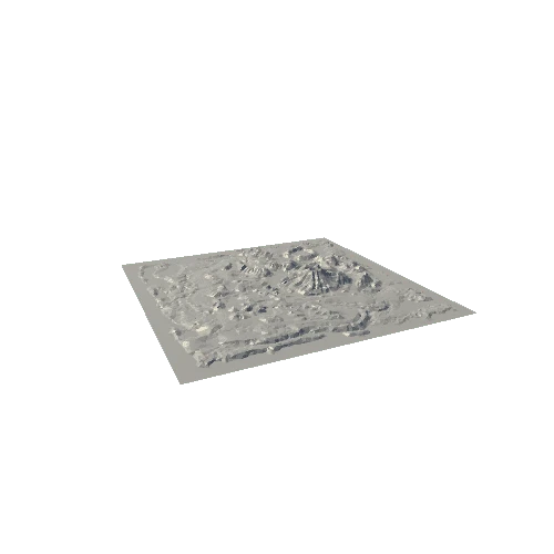
The Mapbox sat image captures the boundary between the protected and not protected area of the National Park. The land was first formally protected in 1881, within a 9.6 km radius of the mountain summit.
Generator: DEM Net Elevation API - https://elevationapi.com
Digital Elevation Model: AW3D30 OpenTopography - https://opentopography.org/
Imagery: MapBox Satellite - https://www.mapbox.com
* Generator: [DEM Net Elevation API](https://elevationapi.com)
* Digital Elevation Model: [AW3D30 OpenTopography](https://opentopography.org/)
* Imagery: [MapBox Satellite](https://www.mapbox.com)