Select or drop a image or 3D model here to search.
We support JPG, JPEG, PNG, GIF, WEBP, GLB, OBJ, STL, FBX. More formats will be added in the future.
Asset Overview
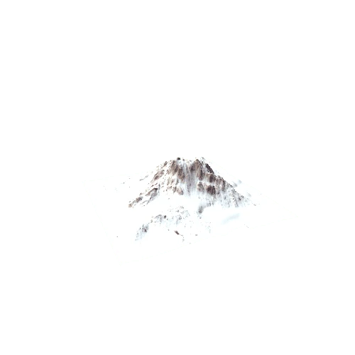
This is a model of LIDAR data collected for Fogo Island (Cape Verde acrhipelago). Blue = low and white = high topography. Fogo is a young volcanic island with a clear shield volcano shape, the caldera and other volcanic cones can be seen in the topography. Note also river valleys cutting into the sides of the island. The island is approx. 25 km in length.