Select or drop a image or 3D model here to search.
We support JPG, JPEG, PNG, GIF, WEBP, GLB, OBJ, STL, FBX. More formats will be added in the future.
Asset Overview
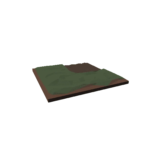
Mount Rainier (4392 m) es un estratovolcán a 90 km al sudeste de la ciudad de Seattle, Washington, EE.UU.
Modelo generado mediante QGIS y Qgis2threejs.
Obra derivada de ALOS Global Digital Surface Model (AW3D30)) e imagen Landsat del servicio World Imagery de ArcGIS online.
Situación geográfica https://osm.org/go/WIZshus4l-?node=1744903493
geo:46.85279,-121.76168?z=17
¿Cómo se hace? Descargar guía en https://tinyurl.com/y76md9bs
Recommended for you