Select or drop a image or 3D model here to search.
We support JPG, JPEG, PNG, GIF, WEBP, GLB, OBJ, STL, FBX. More formats will be added in the future.
Asset Overview
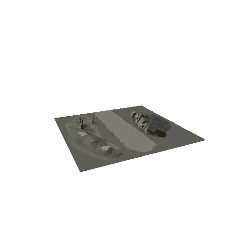
Caerau Roman Fort is located on a north-east facing slope above the Afon Cammarch near Beulah, Powys. It lies adjacent to the main Roman road linking the forts at Llandovery and Castell Collen (Llandrindod Wells) which underlies the modern road to the west.
The site was first recognised as a Roman fort as late as the 1950's. Limited excavations in 1965 dated the occupation of the fort to between 75 and 120 AD. Work by the Clwyd-Powys Archaeological Trust in 1990, 2004 and 2012-15 included new topgraphic survey, geophysical survey and investigative test pitting with trenches across key linear features.
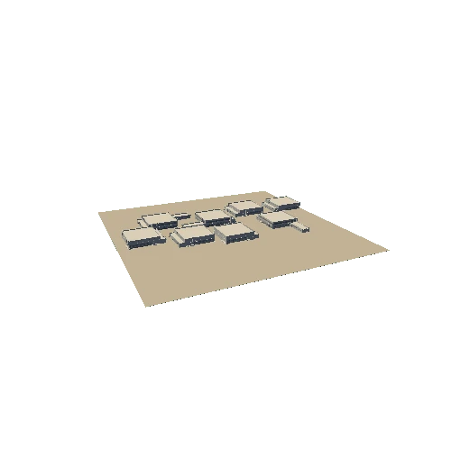
In the 3D model the fort earthworks can be seen on the slope below the farm where the north eastern half of the fort is well preserved and a substantial defensive bank and ditch remain. On the slopes below the fort, earthworks relating to a possible bath house and mansio (inn) can be seen. To the west of the farm a well preserved vicus settlement has been discovered by geophysics.