Select or drop a image or 3D model here to search.
We support JPG, JPEG, PNG, GIF, WEBP, GLB, OBJ, STL, FBX. More formats will be added in the future.
Asset Overview
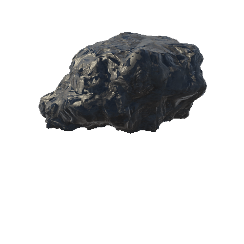
[Source Text](http://webgis.archaeology.ie/historicenvironment/?SMRS=KE047-105001) In pasture, on a SSE-facing slope, just N of a small stream. An irregular shaped rock outcrop (2.3m E-W; 2.1m N-S; H 0.55m) which tilts to the W, is situated on the NW side of a slight mound (6.1m N-S; 4.8m E-W) (Archaeological Survey Unit, UCC). There is extensive rock art (KE047-105----) on the upper and eastern faces, while the W face is blank. The ogham inscription is 'on a natural ridge on the top of the broad face' (Moore in Condit and Corlett 2005, 23). The only plausible reading requires inversion of the H and B series of letters. It then reads from R to L: SE..MAC..QENIAECE....A.......S. The scores (L 7cm; T 1cm) and notches (L 3cm) are cut deeply into the rock, with 1cm between each. A possible standing stone (KE047-106----) is c. 150m to the S. (Moore in Condit and Corlett 2005, 21-36)