Select or drop a image or 3D model here to search.
We support JPG, JPEG, PNG, GIF, WEBP, GLB, OBJ, STL, FBX. More formats will be added in the future.
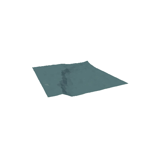
\n
Buildings
\nIncludes three beach houses, each with three color options, a lighthouse and a lifeguard booth.
\nVehicles
\nFeatures an off road truck, an SUV and a van. Each car comes in three colors and with different customisation options, including bull bars, roof racks and luggages. These can be turned on or off in the vehicles' prefabs. The wheels are seperate meshes as well.\nEnvironment
\nIncludes the shore slope assets, water, rocks, palm trees and grass assets.
\n","id":274902333631,"images":{"default":{"featured":[{"href":"https://models-cdn.yahaha.com/63872/shore_underwater_turn/Screenshots/shore_underwater_turn_20.webp"},{"href":"https://models-cdn.yahaha.com/63872/shore_underwater_turn/Screenshots/shore_underwater_turn_50.webp"},{"href":"https://models-cdn.yahaha.com/63872/shore_underwater_turn/Screenshots/shore_underwater_turn_80.webp"},{"href":"https://models-cdn.yahaha.com/63872/shore_underwater_turn/Screenshots/shore_underwater_turn_110.webp"},{"href":"https://models-cdn.yahaha.com/63872/shore_underwater_turn/Screenshots/shore_underwater_turn_140.webp"},{"href":"https://models-cdn.yahaha.com/63872/shore_underwater_turn/Screenshots/shore_underwater_turn_170.webp"},{"href":"https://models-cdn.yahaha.com/63872/shore_underwater_turn/Screenshots/shore_underwater_turn_200.webp"},{"href":"https://models-cdn.yahaha.com/63872/shore_underwater_turn/Screenshots/shore_underwater_turn_230.webp"},{"href":"https://models-cdn.yahaha.com/63872/shore_underwater_turn/Screenshots/shore_underwater_turn_260.webp"},{"href":"https://models-cdn.yahaha.com/63872/shore_underwater_turn/Screenshots/shore_underwater_turn_290.webp"},{"href":"https://models-cdn.yahaha.com/63872/shore_underwater_turn/Screenshots/shore_underwater_turn_320.webp"},{"href":"https://models-cdn.yahaha.com/63872/shore_underwater_turn/Screenshots/shore_underwater_turn_350.webp"}],"main":{"href":"https://models-cdn.yahaha.com/63872/shore_underwater_turn/shore_underwater_turn.webp"}}},"license":{"name":"Standard Unity Asset Store EULA","slug":"unity_standard","url":"https://unity.com/legal/as-terms"},"modelCreatedTime":"2023-08-14T05:01:56Z","modelUpdatedTime":"2022-09-03T17:43:03Z","modelUrl":"https://models-cdn.yahaha.com/63872/shore_underwater_turn.obs.glb","name":"shore_underwater_turn","originSource":"ASSET_STORE","packageId":"63872","packageInfo":{"icon":"//assetstorev1-prd-cdn.unity3d.com/key-image/f70f2153-65c6-4380-a650-0b1c64a2ed1d.webp","name":"Flat Shores"},"polygonCount":12,"publishedDate":"2016-06-08T22:40:28Z","publisher":{"id":"19293","name":"Flat Models","url":"https://sketchfab.com/flatmodels"},"rigged":false,"slug":"shore_underwater_turn-274902333631","sourceUrl":"https://assetstore.unity.com/packages/slug/63872?aid=1011loDfK","stats":{"viewCount":1},"tags":null,"vertexCount":0},{"animatedCount":0,"categories":[{"id":9999,"name":"Others","slug":"miscs"}],"colors":[],"description":"* [Helladic.info Link](http://helladic.info/DEV/MAP/MAPC/pkey_report_wparam.php?place=C6713)\r\n* Data: [Myceanean Atlas Project](https://helladic.info)\r\n* Generator: [DEM Net Elevation API](https://elevationapi.com)\r\n* Elevation: [NASADEM](https://doi.org/10.5067/MEaSUREs/NASADEM/NASADEM_HGT.001)\r\n* Data: OpenStreetMap and Contributors [www.openstreetmap.org](https://www.openstreetmap.org)\r\n* Imagery: [ThunderForest](https://www.thunderforest.com)","downloadable":true,"embedUrl":"https://sketchfab.com/models/167de798a49e45788c92dc402e769ffa/embed","fileSize":291172,"free":true,"id":274892946940,"images":{"default":{"featured":[{"href":"https://models-cdn.yahaha.com/objaverse/167de798a49e45788c92dc402e769ffa/images/b6ecb5b8bbdd4886876d26c5b1e4041e.jpeg"},{"href":"https://models-cdn.yahaha.com/objaverse/167de798a49e45788c92dc402e769ffa/images/fa3484341b0b454ea60b3897f1c422b1.jpeg"},{"href":"https://models-cdn.yahaha.com/objaverse/167de798a49e45788c92dc402e769ffa/images/b0fbb839840c44c681f642ec17b7f19d.jpeg"},{"href":"https://models-cdn.yahaha.com/objaverse/167de798a49e45788c92dc402e769ffa/images/28daff55ae5c4eb98373863f83e8a05a.jpeg"},{"href":"https://models-cdn.yahaha.com/objaverse/167de798a49e45788c92dc402e769ffa/images/336762d010c64958b68919d002e774bf.jpeg"}],"main":{"href":"https://models-cdn.yahaha.com/objaverse/167de798a49e45788c92dc402e769ffa/images/b0fbb839840c44c681f642ec17b7f19d.jpeg"}}},"license":{"name":"CC BY-NC-SA 4.0","slug":"by-nc-sa","url":"https://creativecommons.org/licenses/by-nc-sa/4.0/"},"modelCreatedTime":"2020-04-07T10:20:12Z","modelUpdatedTime":"2020-04-07T10:20:12Z","name":"C6713 Mycenaean Tholos Tomb","originSource":"SKETCHFAB","packageId":"167de798a49e45788c92dc402e769ffa","polygonCount":3822,"publishedDate":"2020-04-07T10:20:12Z","publisher":{"avatar":"https://media.sketchfab.com/avatars/3be4602927af4d07a871ac67f94cad56/671d0df0e4b3474a92598dac781f9fd0.jpeg","name":"Mycenaean Atlas Project","profileUrl":"https://sketchfab.com/mycenaean-atlas-project"},"rigged":false,"slug":"c6713_mycenaean_tholos_tomb-274892946940","sourceUrl":"https://sketchfab.com/3d-models/167de798a49e45788c92dc402e769ffa","stats":{"viewCount":0},"tags":["elevationapi","mycenaean-atlas"],"vertexCount":2000},{"animatedCount":0,"categories":[{"id":9999,"name":"Others","slug":"miscs"}],"colors":[],"description":"* [Helladic.info Link](http://helladic.info/DEV/MAP/MAPC/pkey_report_wparam.php?place=C586)\r\n* Data: [Myceanean Atlas Project](https://helladic.info)\r\n* Generator: [DEM Net Elevation API](https://elevationapi.com)\r\n* Elevation: [NASADEM](https://doi.org/10.5067/MEaSUREs/NASADEM/NASADEM_HGT.001)\r\n* Data: OpenStreetMap and Contributors [www.openstreetmap.org](https://www.openstreetmap.org)\r\n* Imagery: [ThunderForest](https://www.thunderforest.com)","downloadable":true,"embedUrl":"https://sketchfab.com/models/6eae83e2f55c4789ba0685b6c1015acc/embed","fileSize":264944,"free":true,"id":274893028170,"images":{"default":{"featured":[{"href":"https://models-cdn.yahaha.com/objaverse/6eae83e2f55c4789ba0685b6c1015acc/images/699bdb2df591403da7ef8b7ea07adaee.jpeg"},{"href":"https://models-cdn.yahaha.com/objaverse/6eae83e2f55c4789ba0685b6c1015acc/images/dc59bafbc7ed433b95d417726b823166.jpeg"},{"href":"https://models-cdn.yahaha.com/objaverse/6eae83e2f55c4789ba0685b6c1015acc/images/1db66ba749a24603b26edb1fa116e261.jpeg"},{"href":"https://models-cdn.yahaha.com/objaverse/6eae83e2f55c4789ba0685b6c1015acc/images/92bdb676c016446a88a995cfbe0f9d7b.jpeg"},{"href":"https://models-cdn.yahaha.com/objaverse/6eae83e2f55c4789ba0685b6c1015acc/images/3b8892fa68304e809dae1b153effe6fe.jpeg"}],"main":{"href":"https://models-cdn.yahaha.com/objaverse/6eae83e2f55c4789ba0685b6c1015acc/images/1db66ba749a24603b26edb1fa116e261.jpeg"}}},"license":{"name":"CC BY-NC-SA 4.0","slug":"by-nc-sa","url":"https://creativecommons.org/licenses/by-nc-sa/4.0/"},"modelCreatedTime":"2020-04-07T13:33:58Z","modelUpdatedTime":"2020-04-07T13:33:58Z","name":"C586 Kokkolata: Kangelisses","originSource":"SKETCHFAB","packageId":"6eae83e2f55c4789ba0685b6c1015acc","polygonCount":3822,"publishedDate":"2020-04-07T13:33:58Z","publisher":{"avatar":"https://media.sketchfab.com/avatars/3be4602927af4d07a871ac67f94cad56/671d0df0e4b3474a92598dac781f9fd0.jpeg","name":"Mycenaean Atlas Project","profileUrl":"https://sketchfab.com/mycenaean-atlas-project"},"rigged":false,"slug":"c586_kokkolata_kangelisses-274893028170","sourceUrl":"https://sketchfab.com/3d-models/6eae83e2f55c4789ba0685b6c1015acc","stats":{"viewCount":1},"tags":["elevationapi","mycenaean-atlas"],"vertexCount":2000},{"animatedCount":0,"categories":[{"id":9999,"name":"Others","slug":"miscs"}],"colors":["blue","gray","cyan","red","brown","purple"],"description":"* [Helladic.info Link](http://helladic.info/DEV/MAP/MAPC/pkey_report_wparam.php?place=C5422)\r\n* Data: [Myceanean Atlas Project](https://helladic.info)\r\n* Generator: [DEM Net Elevation API](https://elevationapi.com)\r\n* Elevation: [NASADEM](https://doi.org/10.5067/MEaSUREs/NASADEM/NASADEM_HGT.001)\r\n* Data: OpenStreetMap and Contributors [www.openstreetmap.org](https://www.openstreetmap.org)\r\n* Imagery: [ThunderForest](https://www.thunderforest.com)","downloadable":true,"embedUrl":"https://sketchfab.com/models/44f4770e993e4dfbbfa716a3e9c6d3d2/embed","fileSize":257752,"free":true,"id":274893733473,"images":{"default":{"featured":[{"href":"https://models-cdn.yahaha.com/objaverse/44f4770e993e4dfbbfa716a3e9c6d3d2/images/5d840f1093224aaf81400a24186ceb16.jpeg"},{"href":"https://models-cdn.yahaha.com/objaverse/44f4770e993e4dfbbfa716a3e9c6d3d2/images/6d96905f213b429eaf42270a34f31dcd.jpeg"},{"href":"https://models-cdn.yahaha.com/objaverse/44f4770e993e4dfbbfa716a3e9c6d3d2/images/5fb83991ab784228980b82e264f8b099.jpeg"},{"href":"https://models-cdn.yahaha.com/objaverse/44f4770e993e4dfbbfa716a3e9c6d3d2/images/77b8eb87bc504454b650b60885b47aa7.jpeg"},{"href":"https://models-cdn.yahaha.com/objaverse/44f4770e993e4dfbbfa716a3e9c6d3d2/images/6a472565a13b4b7393f1ed1aedacd210.jpeg"}],"main":{"href":"https://models-cdn.yahaha.com/objaverse/44f4770e993e4dfbbfa716a3e9c6d3d2/images/5fb83991ab784228980b82e264f8b099.jpeg"}}},"license":{"name":"CC BY-NC-SA 4.0","slug":"by-nc-sa","url":"https://creativecommons.org/licenses/by-nc-sa/4.0/"},"modelCreatedTime":"2020-04-07T13:02:17Z","modelUpdatedTime":"2020-04-07T13:02:17Z","name":"C5422 Zophoroi: B?l?gris A","originSource":"SKETCHFAB","packageId":"44f4770e993e4dfbbfa716a3e9c6d3d2","polygonCount":4016,"publishedDate":"2020-04-07T13:02:17Z","publisher":{"avatar":"https://media.sketchfab.com/avatars/3be4602927af4d07a871ac67f94cad56/671d0df0e4b3474a92598dac781f9fd0.jpeg","name":"Mycenaean Atlas Project","profileUrl":"https://sketchfab.com/mycenaean-atlas-project"},"rigged":false,"slug":"c5422_zophoroi_b_l_gris_a-274893733473","sourceUrl":"https://sketchfab.com/3d-models/44f4770e993e4dfbbfa716a3e9c6d3d2","stats":{"viewCount":0},"tags":["elevationapi","mycenaean-atlas"],"vertexCount":2103},{"animatedCount":0,"categories":[{"id":9999,"name":"Others","slug":"miscs"}],"colors":["gray","blue","black","cyan","purple"],"downloadable":true,"embedUrl":"https://sketchfab.com/models/714612c2bc6342d998c2e89aec813d74/embed","fileSize":67809976,"free":true,"id":274893949348,"images":{"default":{"featured":[{"href":"https://models-cdn.yahaha.com/objaverse/714612c2bc6342d998c2e89aec813d74/images/c49b4c579bc4494daa81b35afa2b2e3c.jpeg"},{"href":"https://models-cdn.yahaha.com/objaverse/714612c2bc6342d998c2e89aec813d74/images/01d9ecdd2a6544e9b63f1dbc301fe517.jpeg"},{"href":"https://models-cdn.yahaha.com/objaverse/714612c2bc6342d998c2e89aec813d74/images/9c86cca0b8aa4c64a67a47a1c83dc644.jpeg"},{"href":"https://models-cdn.yahaha.com/objaverse/714612c2bc6342d998c2e89aec813d74/images/6b984efc605e4622a9fef4d25cce9daf.jpeg"},{"href":"https://models-cdn.yahaha.com/objaverse/714612c2bc6342d998c2e89aec813d74/images/79df72665ddc4e99b2e686f25fab8c1e.jpeg"}],"main":{"href":"https://models-cdn.yahaha.com/objaverse/714612c2bc6342d998c2e89aec813d74/images/9c86cca0b8aa4c64a67a47a1c83dc644.jpeg"}}},"license":{"name":"CC BY 4.0","slug":"by","url":"https://creativecommons.org/licenses/by/4.0/"},"modelCreatedTime":"2022-05-31T19:53:30Z","modelUpdatedTime":"2022-05-31T19:53:30Z","name":"scene_mesh_textured","originSource":"SKETCHFAB","packageId":"714612c2bc6342d998c2e89aec813d74","polygonCount":1537759,"publishedDate":"2022-05-31T19:53:30Z","publisher":{"avatar":"https://media.sketchfab.com/avatars/51af6a870cce449eb75b0345feebaebb/2ef0f894055b4bb69123b2a27fa2d379.jpeg","name":"mikesmol","profileUrl":"https://sketchfab.com/mikesmol"},"rigged":false,"slug":"scene_mesh_textured-274893949348","sourceUrl":"https://sketchfab.com/3d-models/714612c2bc6342d998c2e89aec813d74","stats":{"viewCount":0},"tags":null,"vertexCount":1040325},{"animatedCount":0,"categories":[{"id":9999,"name":"Others","slug":"miscs"}],"colors":["gray","yellow","red","brown","cyan","orange","green","blue"],"description":"Sculpture by Andre Braun\n\n📍 [North Head, Manly, NSW](https://scaniver.se/L-33.81400,151.28806)","downloadable":true,"embedUrl":"https://sketchfab.com/models/93d1e74cb8dc434d90eb21536cef1ab6/embed","fileSize":1797976,"free":true,"id":274894021579,"images":{"default":{"featured":[{"href":"https://models-cdn.yahaha.com/objaverse/93d1e74cb8dc434d90eb21536cef1ab6/images/8b831935915b4cbd9b58050c6979d356.jpeg"},{"href":"https://models-cdn.yahaha.com/objaverse/93d1e74cb8dc434d90eb21536cef1ab6/images/8c03160ac4cb44aaa3f8bdbfbcf0e9d8.jpeg"},{"href":"https://models-cdn.yahaha.com/objaverse/93d1e74cb8dc434d90eb21536cef1ab6/images/9b8cb72f8b8a42a289633428bd1e56f5.jpeg"},{"href":"https://models-cdn.yahaha.com/objaverse/93d1e74cb8dc434d90eb21536cef1ab6/images/8bb33b96e9594eddb627575a1653320e.jpeg"},{"href":"https://models-cdn.yahaha.com/objaverse/93d1e74cb8dc434d90eb21536cef1ab6/images/6e22d5c270ee42279f5a12c9fc6241ae.jpeg"}],"main":{"href":"https://models-cdn.yahaha.com/objaverse/93d1e74cb8dc434d90eb21536cef1ab6/images/9b8cb72f8b8a42a289633428bd1e56f5.jpeg"}}},"license":{"name":"CC BY-NC-SA 4.0","slug":"by-nc-sa","url":"https://creativecommons.org/licenses/by-nc-sa/4.0/"},"modelCreatedTime":"2021-10-24T22:28:42Z","modelUpdatedTime":"2021-10-24T22:28:42Z","name":"Sculpture by Andre Braun","originSource":"SKETCHFAB","packageId":"93d1e74cb8dc434d90eb21536cef1ab6","polygonCount":52907,"publishedDate":"2021-10-24T22:28:42Z","publisher":{"avatar":"https://media.sketchfab.com/avatars/78fa317e46024a5283765aa34df5e508/aec92fe9a74e499c98d759362cd7f02f.jpeg","name":"andrebraun.discovery","profileUrl":"https://sketchfab.com/andrebraun.discovery"},"rigged":false,"slug":"sculpture_by_andre_braun-274894021579","sourceUrl":"https://sketchfab.com/3d-models/93d1e74cb8dc434d90eb21536cef1ab6","stats":{"viewCount":5},"tags":["scaniverse"],"vertexCount":28515},{"animatedCount":0,"categories":[{"id":9,"name":"Nature & Plants","slug":"nature-plants"}],"colors":[],"description":"Pocatello ID\r\n\r\n* Generator: [DEM Net Elevation API](https://elevationapi.com)\r\n* Digital Elevation Model: [NASADEM](https://doi.org/10.5067/MEaSUREs/NASADEM/NASADEM_HGT.001)\r\n* Imagery: [MapBox Satellite Street](https://www.mapbox.com)","downloadable":true,"embedUrl":"https://sketchfab.com/models/03c379ee4ca3433ab3f24338e56caf16/embed","fileSize":31801492,"free":true,"id":274894626538,"images":{"default":{"featured":[{"href":"https://models-cdn.yahaha.com/objaverse/03c379ee4ca3433ab3f24338e56caf16/images/78cc9b36080649129bfb46be23833cb3.jpeg"},{"href":"https://models-cdn.yahaha.com/objaverse/03c379ee4ca3433ab3f24338e56caf16/images/9ac5e65f08e44c7184a898d3819356b0.jpeg"},{"href":"https://models-cdn.yahaha.com/objaverse/03c379ee4ca3433ab3f24338e56caf16/images/068f317ccc364914b832c0f191095838.jpeg"},{"href":"https://models-cdn.yahaha.com/objaverse/03c379ee4ca3433ab3f24338e56caf16/images/48159328cf6147eab8aa34d3d426c9c6.jpeg"},{"href":"https://models-cdn.yahaha.com/objaverse/03c379ee4ca3433ab3f24338e56caf16/images/fb541d28192d42168cd39c015a19b96e.jpeg"}],"main":{"href":"https://models-cdn.yahaha.com/objaverse/03c379ee4ca3433ab3f24338e56caf16/images/068f317ccc364914b832c0f191095838.jpeg"}}},"license":{"name":"CC BY-NC-SA 4.0","slug":"by-nc-sa","url":"https://creativecommons.org/licenses/by-nc-sa/4.0/"},"modelCreatedTime":"2022-03-15T20:00:33Z","modelUpdatedTime":"2022-03-15T20:00:33Z","name":"Pocatello, ID","originSource":"SKETCHFAB","packageId":"03c379ee4ca3433ab3f24338e56caf16","polygonCount":1081740,"publishedDate":"2022-03-15T20:00:33Z","publisher":{"avatar":"https://media.sketchfab.com/avatars/3ef1bd11d3eb4b57a0b353e8f2e5fc3e/116042a0854e40538adab302b593683d.jpeg","name":"howeryan","profileUrl":"https://sketchfab.com/howeryan"},"rigged":false,"slug":"pocatello_id-274894626538","sourceUrl":"https://sketchfab.com/3d-models/03c379ee4ca3433ab3f24338e56caf16","stats":{"viewCount":1},"tags":["elevationapi"],"vertexCount":542370},{"animatedCount":0,"categories":[{"id":9999,"name":"Others","slug":"miscs"}],"colors":[],"description":"* [Helladic.info Link](http://helladic.info/DEV/MAP/MAPC/pkey_report_wparam.php?place=C1419)\r\n* Data: [Myceanean Atlas Project](https://helladic.info)\r\n* Generator: [DEM Net Elevation API](https://elevationapi.com)\r\n* Elevation: [NASADEM](https://doi.org/10.5067/MEaSUREs/NASADEM/NASADEM_HGT.001)\r\n* Data: OpenStreetMap and Contributors [www.openstreetmap.org](https://www.openstreetmap.org)\r\n* Imagery: [ThunderForest](https://www.thunderforest.com)","downloadable":true,"embedUrl":"https://sketchfab.com/models/75c55daf86cc4e139e7b555762d7f415/embed","fileSize":378800,"free":true,"id":274893683375,"images":{"default":{"featured":[{"href":"https://models-cdn.yahaha.com/objaverse/75c55daf86cc4e139e7b555762d7f415/images/89e615deafec44febf59a7b4ae4b98e8.jpeg"},{"href":"https://models-cdn.yahaha.com/objaverse/75c55daf86cc4e139e7b555762d7f415/images/071fe7242ecd45b4b7e1ea2f9a1aec30.jpeg"},{"href":"https://models-cdn.yahaha.com/objaverse/75c55daf86cc4e139e7b555762d7f415/images/522d77890e5d40b4a116d567bf2687bb.jpeg"},{"href":"https://models-cdn.yahaha.com/objaverse/75c55daf86cc4e139e7b555762d7f415/images/5c8491e42adf4cda8c75dd108f4041ce.jpeg"},{"href":"https://models-cdn.yahaha.com/objaverse/75c55daf86cc4e139e7b555762d7f415/images/cce97f11899e467e941cc968e53c284d.jpeg"}],"main":{"href":"https://models-cdn.yahaha.com/objaverse/75c55daf86cc4e139e7b555762d7f415/images/522d77890e5d40b4a116d567bf2687bb.jpeg"}}},"license":{"name":"CC BY-NC-SA 4.0","slug":"by-nc-sa","url":"https://creativecommons.org/licenses/by-nc-sa/4.0/"},"modelCreatedTime":"2020-04-04T14:46:11Z","modelUpdatedTime":"2020-04-04T14:46:11Z","name":"C1419 Linopotis Piyi","originSource":"SKETCHFAB","packageId":"75c55daf86cc4e139e7b555762d7f415","polygonCount":4712,"publishedDate":"2020-04-04T14:46:11Z","publisher":{"avatar":"https://media.sketchfab.com/avatars/3be4602927af4d07a871ac67f94cad56/671d0df0e4b3474a92598dac781f9fd0.jpeg","name":"Mycenaean Atlas Project","profileUrl":"https://sketchfab.com/mycenaean-atlas-project"},"rigged":false,"slug":"c1419_linopotis_piyi-274893683375","sourceUrl":"https://sketchfab.com/3d-models/75c55daf86cc4e139e7b555762d7f415","stats":{"viewCount":1},"tags":["elevationapi","mycenaean-atlas"],"vertexCount":2656},{"animatedCount":0,"categories":[{"id":5,"name":"Art & History","slug":"art-history"}],"colors":["cyan"],"description":"Low poly 3d modular art package with about 1090 assets.
Features
- 496 modular building parts
- 84 modular terrain meshes
- 290 props
- 12 buildings with interiors
Content
-> Nature: clouds (3), bushes (2), flowers (11), grass (8), terrain generic (12), mushrooms (3), plants (6), rocks (8), trees (8), trees background (4), terrain modular (84)
-> Props: building signs (4), flower boxes (3), flower pots (12), wall shields (6), carpets (1), bottles (18), barrels (7), baskets (8), bathtubs (2), bowls (6), crates (7), jars (2), jugs (6), potions (21), pots (4), sacks (6), vases (2), beds (11), benches (6), chairs (3), shelves (20), tables (6), hangers (9), ladders (4), light (10), misc (14), shields (7), wagons (3), workshop (82)
-> Structures: basement (3), chimneys (4), door frames (8), doors (8), floors (17), roof ends (100), roofs (93), roof windows (15), roof support (75), stairs exterior (4), stairs interior (50), support beams (6), wall connectors (14), walls (55), windows (29), buildings exterior (12), awnings (5), balconies (8), fences (9), path (3), sheds (6), stockpiles (12), gate balconies (20), gate doors (10), small gates (3), stockade (14), towers (17), wall platforms (62)
Support
- Built-in Render Pipeline
- Universal Render Pipeline (URP)
- Unity 2019.4.0 or higher
URP supported by included external package
Polygon count: 40 to 29 000
All main assets use single texture (2048x2048) with two alternative colors. Some prefabs (clouds, sky) use different texture and material.
","fileSize":"122449883","id":274882709047,"images":{"default":{"featured":[{"href":"https://models-cdn.yahaha.com/00179979/rpgpp_ag_terrain_hill_01a_10x10m/Screenshots/rpgpp_ag_terrain_hill_01a_10x10m_20.png"},{"href":"https://models-cdn.yahaha.com/00179979/rpgpp_ag_terrain_hill_01a_10x10m/Screenshots/rpgpp_ag_terrain_hill_01a_10x10m_50.png"},{"href":"https://models-cdn.yahaha.com/00179979/rpgpp_ag_terrain_hill_01a_10x10m/Screenshots/rpgpp_ag_terrain_hill_01a_10x10m_80.png"},{"href":"https://models-cdn.yahaha.com/00179979/rpgpp_ag_terrain_hill_01a_10x10m/Screenshots/rpgpp_ag_terrain_hill_01a_10x10m_110.png"},{"href":"https://models-cdn.yahaha.com/00179979/rpgpp_ag_terrain_hill_01a_10x10m/Screenshots/rpgpp_ag_terrain_hill_01a_10x10m_140.png"},{"href":"https://models-cdn.yahaha.com/00179979/rpgpp_ag_terrain_hill_01a_10x10m/Screenshots/rpgpp_ag_terrain_hill_01a_10x10m_170.png"},{"href":"https://models-cdn.yahaha.com/00179979/rpgpp_ag_terrain_hill_01a_10x10m/Screenshots/rpgpp_ag_terrain_hill_01a_10x10m_200.png"},{"href":"https://models-cdn.yahaha.com/00179979/rpgpp_ag_terrain_hill_01a_10x10m/Screenshots/rpgpp_ag_terrain_hill_01a_10x10m_230.png"},{"href":"https://models-cdn.yahaha.com/00179979/rpgpp_ag_terrain_hill_01a_10x10m/Screenshots/rpgpp_ag_terrain_hill_01a_10x10m_260.png"},{"href":"https://models-cdn.yahaha.com/00179979/rpgpp_ag_terrain_hill_01a_10x10m/Screenshots/rpgpp_ag_terrain_hill_01a_10x10m_290.png"},{"href":"https://models-cdn.yahaha.com/00179979/rpgpp_ag_terrain_hill_01a_10x10m/Screenshots/rpgpp_ag_terrain_hill_01a_10x10m_320.png"},{"href":"https://models-cdn.yahaha.com/00179979/rpgpp_ag_terrain_hill_01a_10x10m/Screenshots/rpgpp_ag_terrain_hill_01a_10x10m_350.png"}],"main":{"href":"https://models-cdn.yahaha.com/00179979/rpgpp_ag_terrain_hill_01a_10x10m/rpgpp_ag_terrain_hill_01a_10x10m.png"}}},"license":{"name":"Standard Unity Asset Store EULA","slug":"unity_standard","url":"https://unity.com/legal/as-terms"},"modelCreatedTime":"2020-09-30T12:59:18Z","modelUpdatedTime":"2022-03-09T08:52:43Z","modelUrl":"https://models-cdn.yahaha.com/00179979/rpgpp_ag_terrain_hill_01a_10x10m.obs.glb","name":"rpgpp_ag_terrain_hill_01a_10x10m","originSource":"ASSET_STORE","packageId":"179979","packageInfo":{"icon":"//assetstorev1-prd-cdn.unity3d.com/key-image/7e47f983-11a2-4bc5-a593-ae8197a312ca.webp","name":"RPG Poly Pack - Ancient Gauls"},"polygonCount":136,"publishedDate":null,"publisher":{"name":"Gigel"},"rigged":false,"slug":"rpgpp_ag_terrain_hill_01a_10x10m-274882709047","sourceUrl":"https://assetstore.unity.com/packages/slug/179979?aid=1011loDfK","stats":{"viewCount":5},"tags":["RPG Poly Pack - Ancient Gauls","lowpoly","city","buildings","modular","interiors","fantasy","village","medieval","polygon","gallic"],"unityVersions":["2019.4.0"],"vertexCount":0},{"animatedCount":0,"categories":[{"id":5,"name":"Art & History","slug":"art-history"}],"colors":["gray","cyan","blue","green","purple"],"description":"St Gregoire Cemetery Vankleek Hill Ontario Canada - Medium Resolution version\n\nImages were captured using the DJI Mavic Enterprise Dual Camera featuring rgb and thermal cameras. \n\nDroneHarmony+ was the mission planning software managing the flight path of the drone and image capture.\n\nImages were processed and rendered into the 3d model using the Pix4D Modeler\n\nThe finished model is hosted on Sketchfab for public viewing.\n\nPilot: Phil Frankow\nCompany: Eastern Ontario Drones Corp. VanKleek Hill Ontario Canada.","downloadable":true,"embedUrl":"https://sketchfab.com/models/484b48e60d4b45dfb521132f369db5f4/embed","fileSize":39132796,"free":true,"id":274893690874,"images":{"default":{"featured":[{"href":"https://models-cdn.yahaha.com/objaverse/484b48e60d4b45dfb521132f369db5f4/images/0962575ae99f4120bc0b5c607b61c9f8.jpeg"},{"href":"https://models-cdn.yahaha.com/objaverse/484b48e60d4b45dfb521132f369db5f4/images/bb11266132ea464094e126b7e63ff24c.jpeg"},{"href":"https://models-cdn.yahaha.com/objaverse/484b48e60d4b45dfb521132f369db5f4/images/28196523896d4bc2a3d6cac19f428826.jpeg"},{"href":"https://models-cdn.yahaha.com/objaverse/484b48e60d4b45dfb521132f369db5f4/images/88fb19c001ad45419e9b6ff543ae9f82.jpeg"},{"href":"https://models-cdn.yahaha.com/objaverse/484b48e60d4b45dfb521132f369db5f4/images/539f7a0177bd4c339fe0f73a6d79e1e2.jpeg"}],"main":{"href":"https://models-cdn.yahaha.com/objaverse/484b48e60d4b45dfb521132f369db5f4/images/28196523896d4bc2a3d6cac19f428826.jpeg"}}},"license":{"name":"CC BY 4.0","slug":"by","url":"https://creativecommons.org/licenses/by/4.0/"},"modelCreatedTime":"2019-11-14T04:21:40Z","modelUpdatedTime":"2019-11-14T04:21:40Z","name":"St Gregoire Cemetery VanKleek Hill ON - Med. Res","originSource":"SKETCHFAB","packageId":"484b48e60d4b45dfb521132f369db5f4","polygonCount":999999,"publishedDate":"2019-11-14T04:21:40Z","publisher":{"avatar":"https://media.sketchfab.com/avatars/51af6a870cce449eb75b0345feebaebb/2ef0f894055b4bb69123b2a27fa2d379.jpeg","name":"eodronecorp","profileUrl":"https://sketchfab.com/eodronecorp"},"rigged":false,"slug":"st_gregoire_cemetery_vankleek_hill_on_med_res-274893690874","sourceUrl":"https://sketchfab.com/3d-models/484b48e60d4b45dfb521132f369db5f4","stats":{"viewCount":7},"tags":["enterprise","hill","dual","historical","cemetery","canada","eastern","corp","drones","camera","ontario","dji","planning","pix4d","mavic","mission","heritage-photogrammetry","droneharmony","sketchfab","vankleek","eodronecorp"],"vertexCount":494083},{"animatedCount":0,"categories":[{"id":12,"name":"Landscape","slug":"landscape"}],"colors":["cyan","black"],"description":"Collection of 50 low poly models of bushes, water plants and arbours.\n