Select or drop a image or 3D model here to search.
We support JPG, JPEG, PNG, GIF, WEBP, GLB, OBJ, STL, FBX. More formats will be added in the future.
Asset Overview
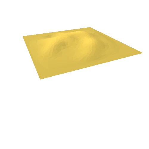
Toquepala is one of the biggest porphyry copper mine located in the Peruvian Andes mountain range (Tacna Region). It is mainly rich in copper, molybdenum, silver with minor gold and zinc deposits. The mine consists of an open-pit, a concentrator plant, and a refinery facility dedicated for extraction and electrowinning.
Generator: DEM Net Elevation API
Digital Elevation Model: NASADEM (30m)
Imagery: Esri Satellite Imagery
* Generator: [DEM Net Elevation API](https://elevationapi.com)
* Mesh reduction: [geometry3Sharp (GradientSpace, Ryan Schmidt) BSL 1.0 License](https://github.com/gradientspace/geometry3Sharp/blob/master/LICENSE)
* Digital Elevation Model: [NASADEM](https://doi.org/10.5067/MEaSUREs/NASADEM/NASADEM_HGT.001)
* Imagery: [Esri World Imagery](https://services.arcgisonline.com/ArcGIS/rest/services/World_Imagery/MapServer)
* Data: [OpenStreetMap and Contributors](http://www.openstreetmap.org)