Select or drop a image or 3D model here to search.
We support JPG, JPEG, PNG, GIF, WEBP, GLB, OBJ, STL, FBX. More formats will be added in the future.
Asset Overview
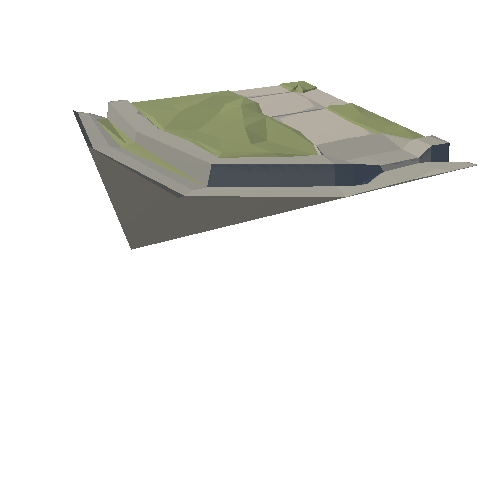
3D model of the Woods Creek watershed in Lexington, Virginia, USA (boundary shown in yellow) with Woods Creek and its perennial tributaries (blue). The full watershed is 7.76 square miles (20 square km) with elevation ranging from 886 to 1955 feet (273 to 596 m) and shown here with 2X vertical exaggeration. The 3D model is based on digital elevation model data from the USGS and the aerial photo is from google Earth.